
Boring Log Software
For Geotechnical
Engineers
Create consistent soil boring logs and manage borehole data from field to final report. Our modern, cloud based platform allows for faster logging, automated reporting, and standardized geotechnical data.
A gINT Replacement Built for US Engineers
With gINT support ending, now is the time to move to a modern boring log platform. TabLogs supports the migration of Bentley gINT databases commonly used across US geotechnical and environmental firms. Import historical data, standardize logs to ASTM D2487 and USCS, and continue working with a modern, cloud-based workflow without disrupting active projects.
Trusted by leading companies worldwide
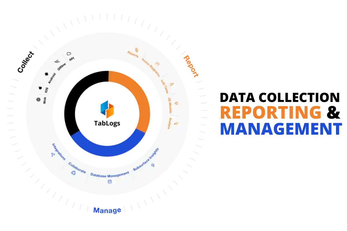
Why Geotechnical Teams Choose TabLogs
Hours Wasted on QA/QC
Manual data entry leads to errors -- and at ~$7 in wages per log, those errors are expensive. Your team spends hours checking logs before they can leave the field.
Built in Validation Built-in validation catches errors in real-time. Reduce QA/QC time by 50% -- and cut log production costs from ~$7 to as little as $1 per log.
Inconsistent Standards
Different loggers, different formats. Maintaining ASTM D2487 compliance across your organization is a nightmare.
Standardized Workflows TabLogs' standardized workflows ensure every log meets industry requirements. Your entire team follows the same process, every time.
Scaling is Painful
Legacy software can't grow with you. Adding new users, projects, or locations becomes a bottleneck.
Modern, Cloud-based Software Our cloud-native platform scales from 5 to 500 users seamlessly. Log 3 inches or 30 feet — TabLogs handles it all.
Geotechnical Boring Log Software Features for Field and Office Teams
Field-Ready Borehole Logging Software with Offline Sync
Eliminate paper logs and manual data entry. Our field-friendly, button-based interface enables engineers to log borehole data efficiently while ensuring compliance with ASTM D2487 classification standards.
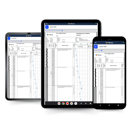
Automated Professional Boring Log Reports
Generate high-quality boring logs with fully customizable templates. Maintain your firm's preferred reporting format while producing standardized, professional reports in moments.
Geotechnical Lab Data and LIMS Integration
Organize and analyze soil and rock samples with ease. Sort by depth, material type, pocket penetration strength, and more to create lab test requests instantly.
High Speed Bulk Data Entry for Office Workflows
Structured bulk edit tables enable fast borehole data entry from contractor logs, legacy PDFs, or centralized office teams. Edit multiple depth intervals at once, capture SPT results efficiently, and duplicate lithology patterns to generate consistent reports without requiring field logging. TabLogs supports field logging, bulk data entry, or hybrid workflows at any stage of adoption.
GIS Mapping and 3D Subsurface Visualization
Visualize borehole data like never before. Automatically plot boreholes onto a 3D site model, adjust surface layers, overlay geologic maps, and gain deeper insights into subsurface conditions.
Geotechnical Data APIs, Integrations, and Standard Exports
Easily import, export, and integrate boring log data with existing software systems. Our flexible API ensures seamless data flow between your geotechnical projects and legacy platforms. Export data in AGS, DIGGS, and CAD-ready formats.
Built for North American standards. Our DOT-aligned log configurations are adopted by leading consulting firms across the region.
400+
Consulting Firms Worldwide
1M+
Boreholes Logged
Millions
Feet of Subsurface Data Captured
99.9%
Uptime Reliability
"TabLogs is definitely the best investment we've made in terms of where the innovation group is trying to get us as a company."
Michael
Farallon - California


Start logging boreholes digitally with a free 14-day trial
Join hundreds of engineering teams who ave already made the switch to modern, cloud-based borehole logging. Start your free trial today — no credit card required.
- 14-day free trial with full access
- Dedicated onboarding support
- Import your existing gINT data
- Unlimited users across your organization, no per seat fees
Get Started with a Free Trial
Chat with one of our geotechnical specialists and get started with a free trial.
Frequently Asked Questions
Everything you need to know about TabLogs. Can't find the answer you're looking for? Contact our team.
Still have questions?
Our team of geotechnical engineers is here to help you get started.