Geotechnical Data Management Software for Borehole and Subsurface Data
TabLogs provides a centralized, cloud-based database for geotechnical and environmental investigation data. Every borehole, CPT, test pit, well, and laboratory result logged in TabLogs becomes structured, searchable data that can be reused across projects. Instead of disconnected files, PDFs, and legacy databases, TabLogs helps engineering teams build a consistent subsurface data repository that grows with every investigation. This enables better desktop studies, reduced investigation risk, and faster decision making across the full project lifecycle.
Database Management
Query & manage subsurface data
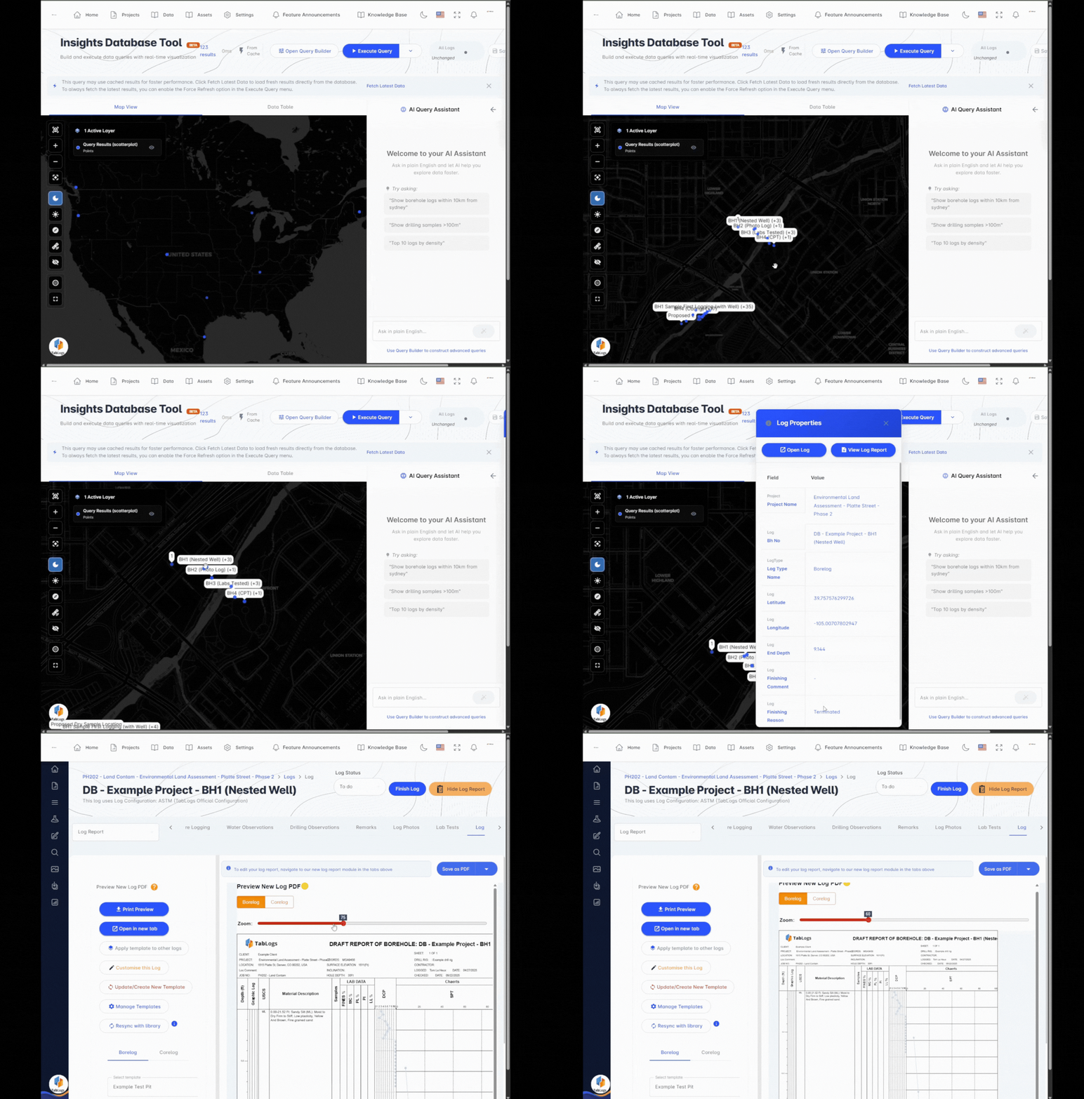
Purpose-Built Geotechnical Data Management Software
TabLogs is designed to function as a true geotechnical database, not just a log creation tool. All investigation data is stored in a structured format that supports long-term data management and reuse. This allows engineers to move beyond static PDFs and build a searchable, reusable subsurface dataset. Use TabLogs to centralize:
- Borehole and core logs
- CPT and in situ test data
- Test pits and trenches
- Groundwater wells and monitoring data
- Laboratory testing results
- Environmental investigation records
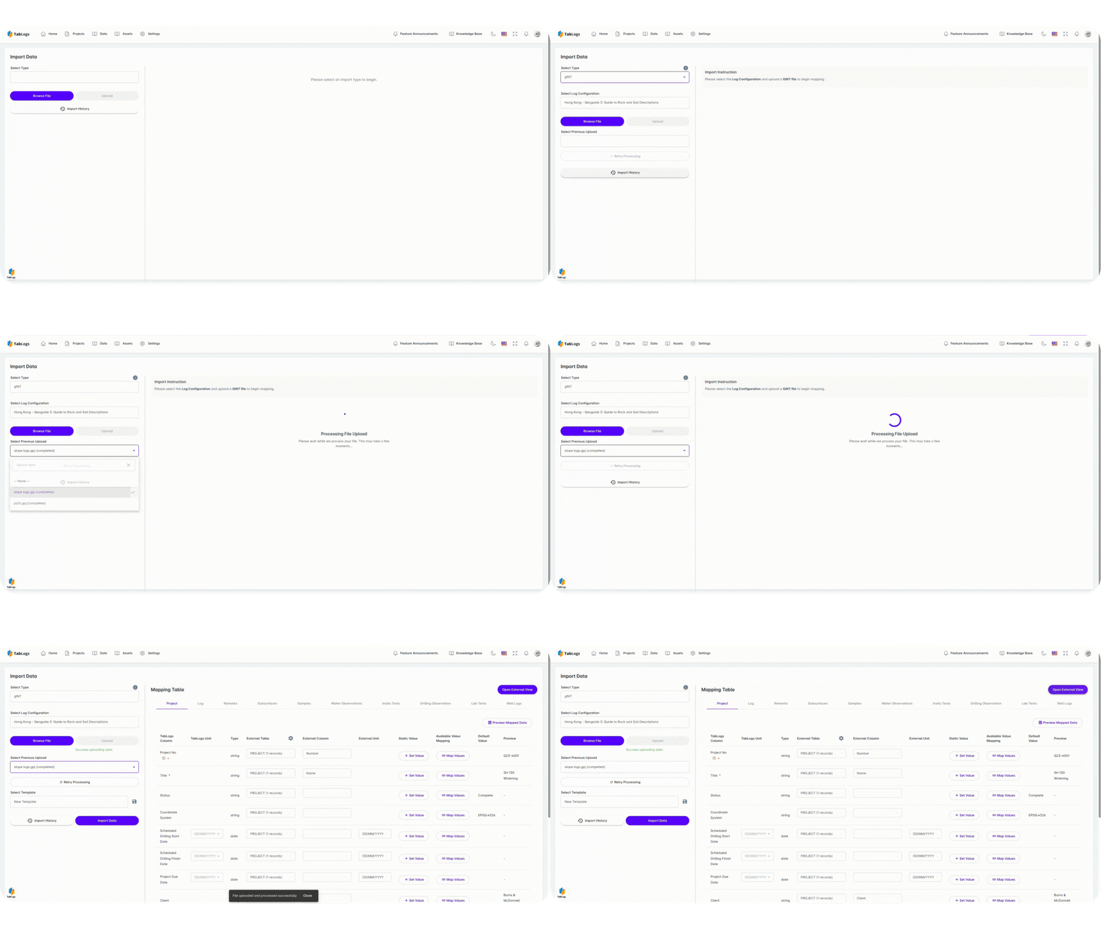
Import and Centralize Legacy Geotechnical Data
Most engineering firms have decades of valuable subsurface data locked away in legacy systems, spreadsheets, PDFs, and older databases. TabLogs is built to bring that data forward. TabLogs allows you to:
- Import legacy borehole and investigation data
- Standardize historical logs into a modern schema
- Preserve data ownership and accessibility
- Avoid vendor lock-in
- Reduce re-entry of historical borehole data
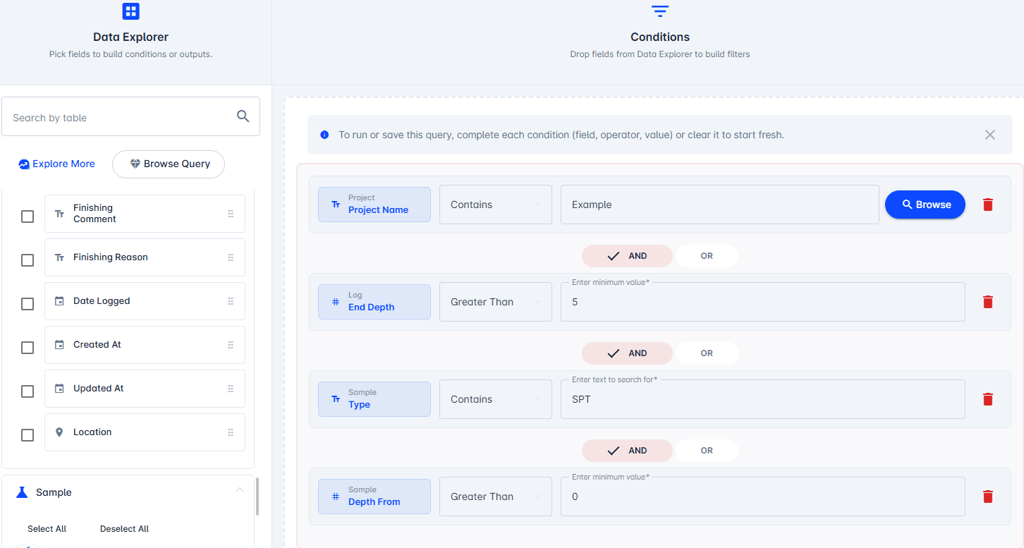
Search and Reuse Historical Borehole Data
As your database grows, TabLogs enables teams to actively use historical data rather than just store it. TabLogs turns historical investigations into an active engineering resource rather than archived records. Engineers can quickly:
- Search boreholes by location, depth, and project
- Filter by lithology, material, or test type
- Reference previous investigations during desktop studies
- Support early-stage feasibility and proposal work
- Reduce uncertainty and over-drilling
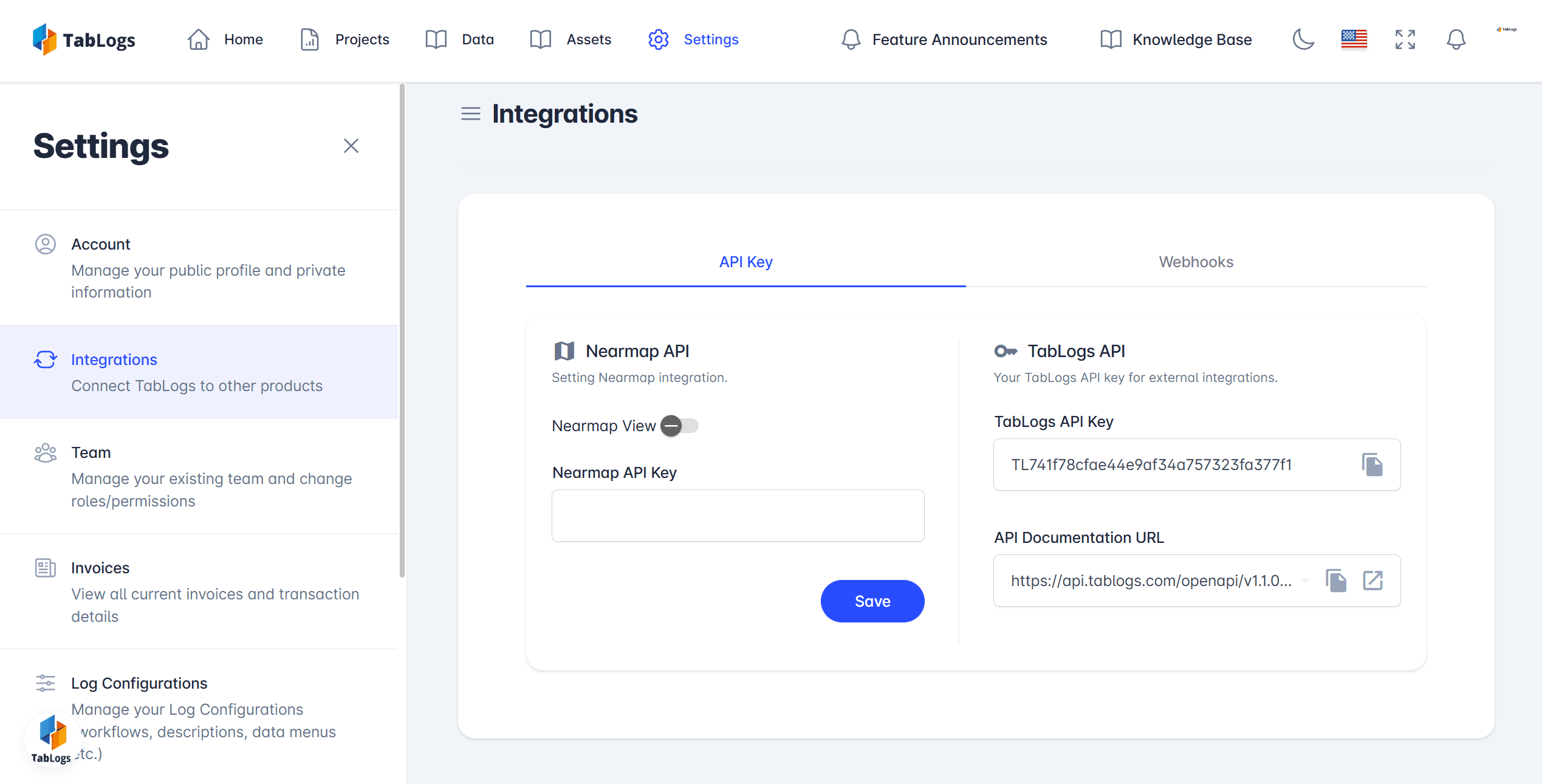
API Access and Integration with Existing Systems
TabLogs is designed to integrate with your existing software ecosystem. Through custom import, export, and API functionality, your geotechnical data remains accessible and portable. APIs are available for enterprise workflows and custom integrations.
- Connect with internal databases and GIS platforms
- Export structured data for analysis and reporting
- Support future workflows and data pipelines
- Maintain full control over your investigation data
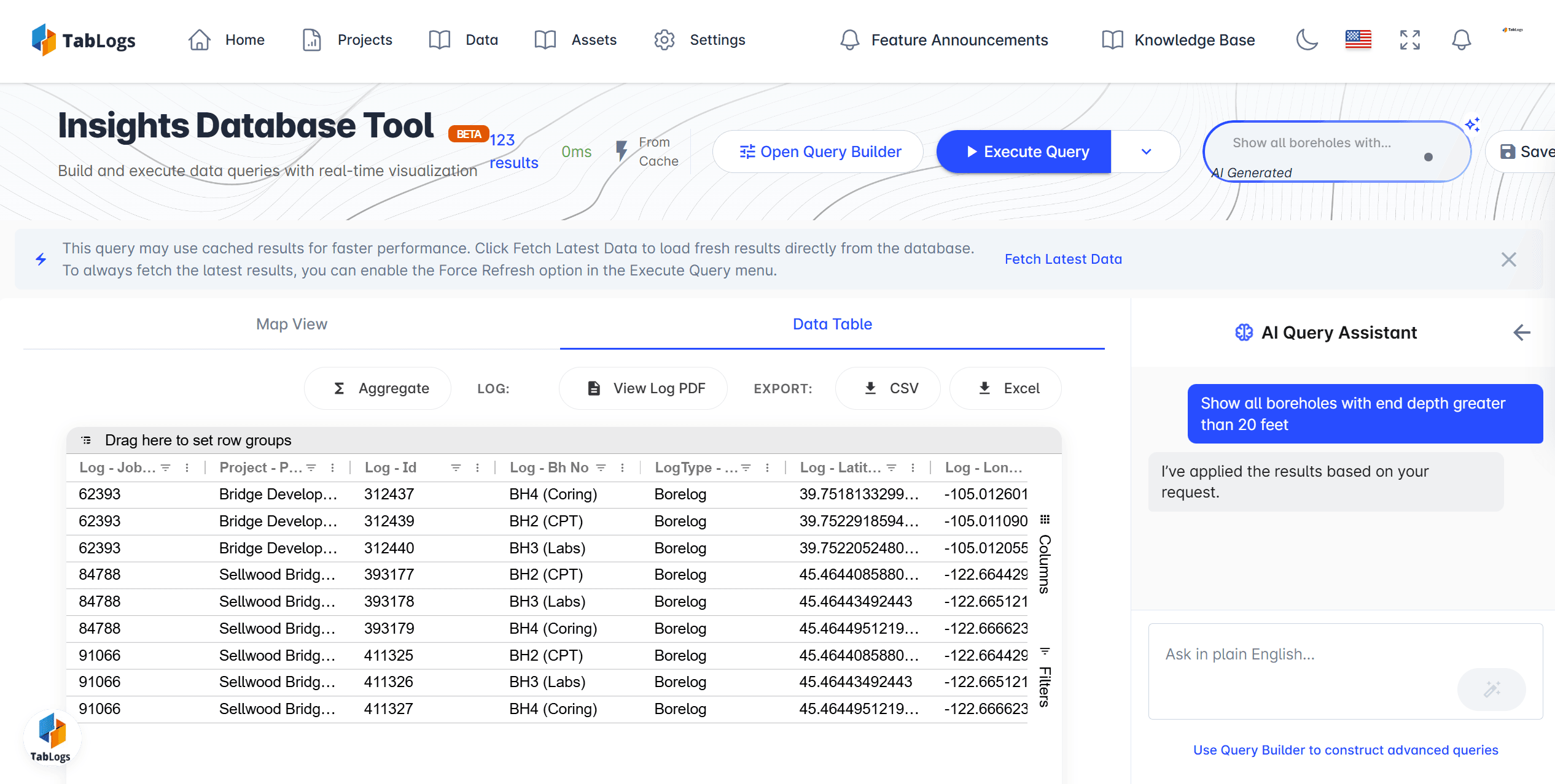
Modern Alternative to Traditional Geotechnical Databases and Legacy Tools
TabLogs offers a modern approach to geotechnical data management, built for field-to-office workflows and long-term data reuse. This approach reduces reliance on disconnected files and project-by-project databases. Compared to traditional systems, TabLogs emphasizes:
- Structured, standardized data
- Cloud accessibility with export control
- DIGGS-first data architecture
- Faster onboarding of legacy data
- Continuous database growth across projects
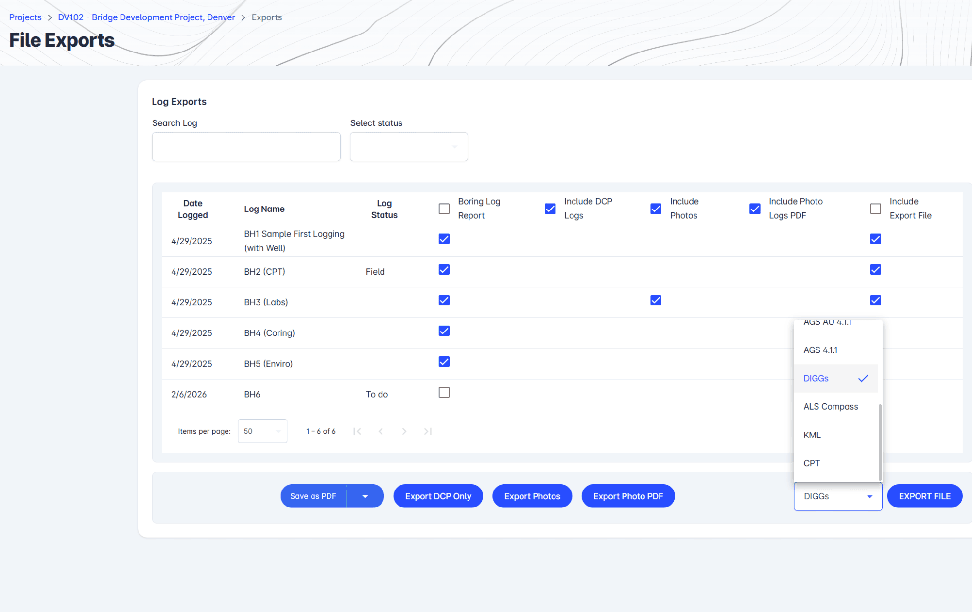
Standardized Borehole Database Supporting DIGGS, DOT, and AGS
TabLogs supports industry-standard data formats used across the US and internationally, allowing teams to standardize how subsurface data is captured and stored. We actively engage in DIGGS interoperability initiatives to ensure alignment with evolving US DOT and federal data exchange standards. DIGGS support is particularly valuable for US-based projects and DOT work where standardized data delivery is increasingly expected. Benefits include:
- Easier data exchange with clients and agencies
- Alignment with DOT and public sector requirements
- Long-term data usability beyond individual projects
- Improved consistency across teams and offices
Ready to manage your data better?
Get all your subsurface data organized in one powerful platform.