Features for Modern Borehole Logging and Geotechnical Teams
TabLogs provides a complete set of tools for digital borehole logging, field data collection, and geotechnical project management. From offline field logging to automated boring log reports, data validation, and visualization, these features are designed to support modern geotechnical and environmental workflows from site investigation through final deliverables.
See TabLogs in action
Watch our 2-minute overview to see how TabLogs can transform your workflow.
Professional Reports, Exports, and Integrations
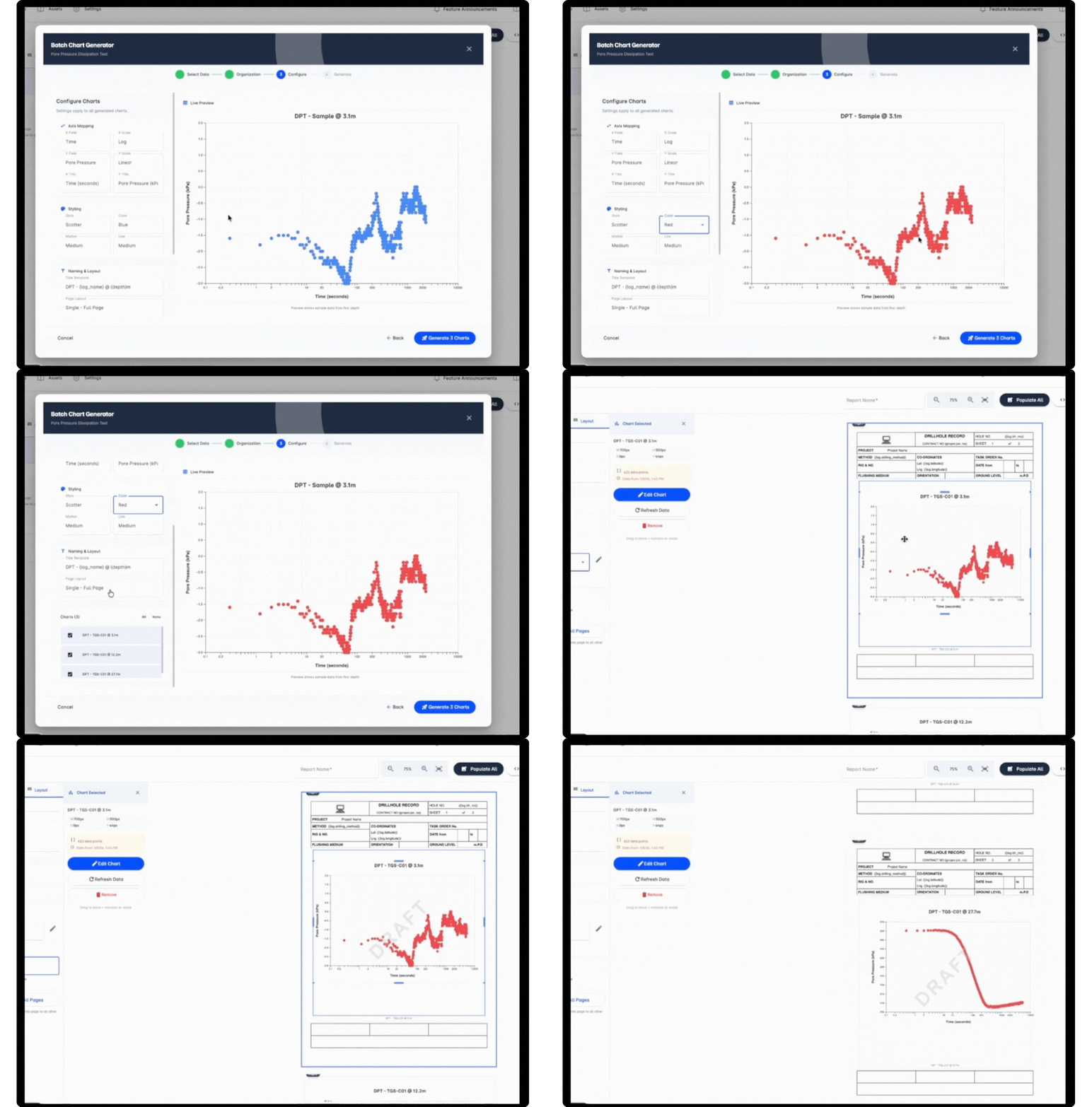
Turn field data into professional deliverables and share it seamlessly across your existing tools and workflows. TabLogs supports the generation of high-quality boring log reports and flexible data exports, allowing geotechnical teams to move information efficiently from field collection to final reporting. Export borehole and subsurface data for use in CAD, GIS, laboratory, and legacy systems, and integrate TabLogs with your broader geotechnical technology stack. Open APIs and standard export formats ensure your data remains accessible, portable, and future-ready as project requirements evolve.
- Professional boring log report outputs
- Flexible data export options for downstream workflows
- Integration with CAD, GIS, and laboratory systems
- Support for structured data exchange and legacy platforms
- Open APIs for custom integrations and automation
Switching From Your Current Boring Log Software?
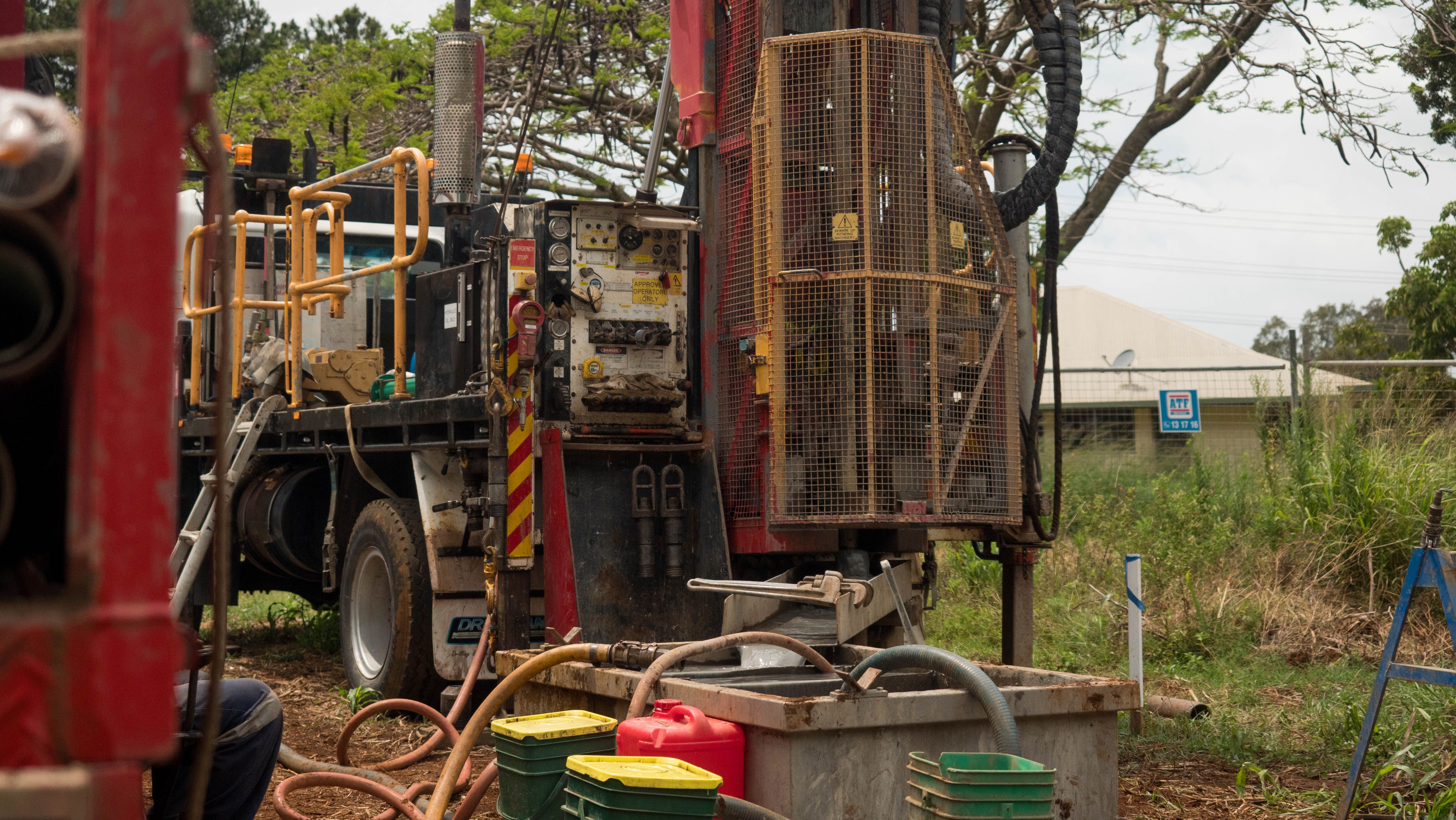
Many geotechnical teams come to TabLogs from legacy logging and data management platforms looking for a more modern, connected workflow. TabLogs is designed to make the transition straightforward -- with data migration support, standardized formats that preserve your historical data, and a platform built for the way geotechnical teams actually work today.
- Dedicated migration support for your existing borehole data
- Standardized formats including DIGGS, AGS and DOT
- Cloud-based platform with offline field logging
- Built-in QA/QC replacing manual spreadsheet checks
- Unlimited users with no per-seat licensing
Built-In QA/QC and Standardized Logging
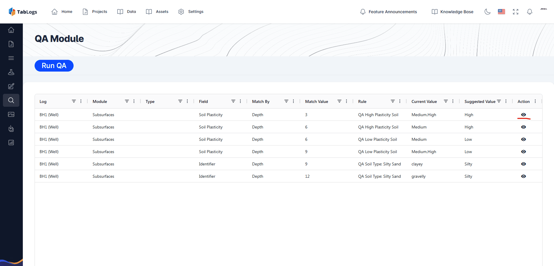
TabLogs includes built-in validation and structured data entry to help teams catch errors as logs are created, not after the fact. Standardized logging workflows reduce variability between field staff, improve consistency across projects, and support quality assurance before data reaches the office. By enforcing consistent classifications and required fields, TabLogs helps geotechnical and environmental teams maintain reliable, review-ready borehole logs while reducing time spent on manual QA/QC and rework.
Plan and Manage Site Investigations from the Office
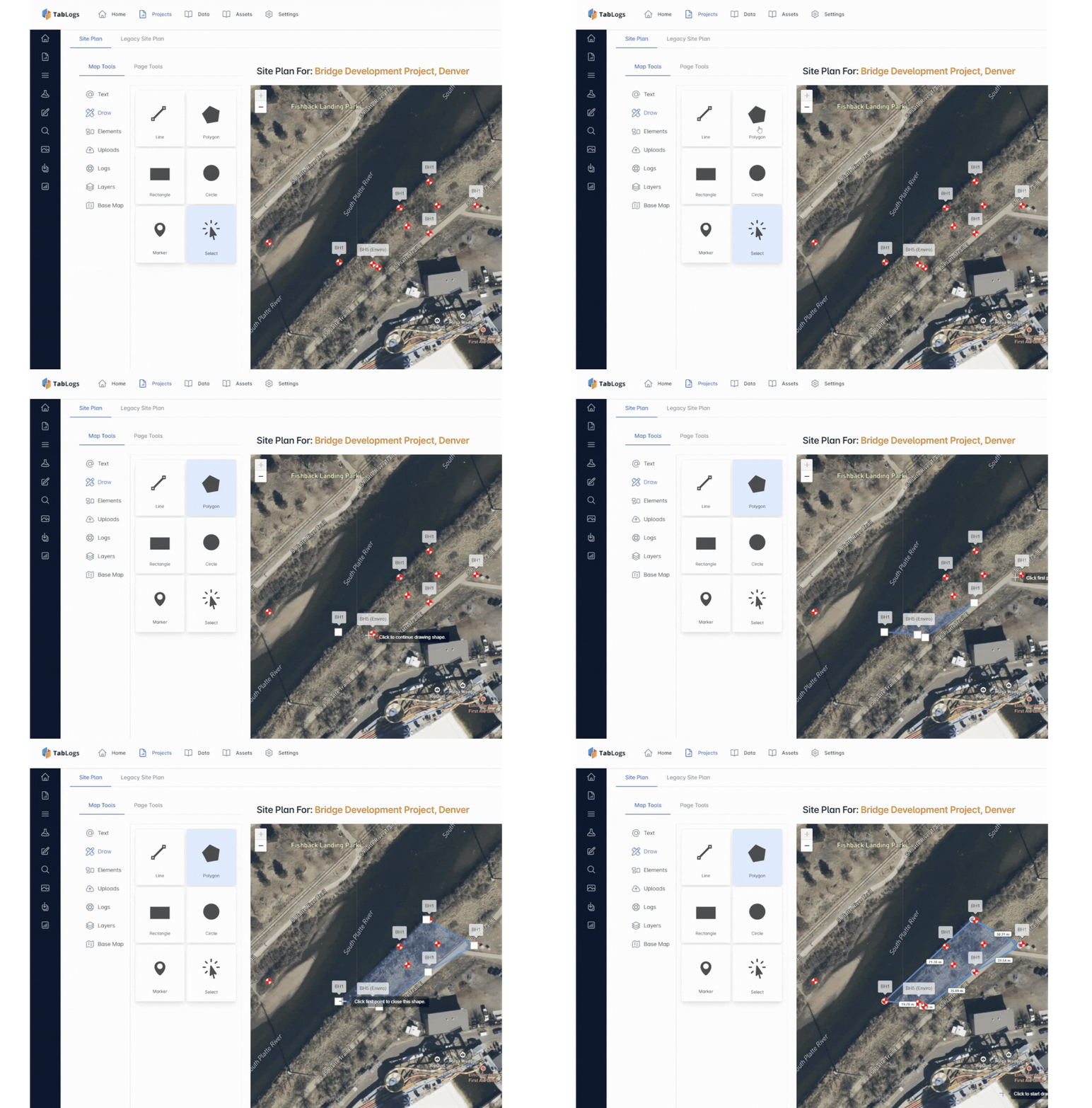
The web app lets you scope and design investigations, assign team members, create timesheets and import data. Once your plan is set, export information into design software or create summary reports
- Propose test/sample schedules
- Assign roles and permissions
- TImesheets
- Import existing databases
- Export data into any existing software package

Built to Integrate Across Vendor Ecosystems, Not Replace Them
Large engineering consultancies rarely operate within a single software stack. Analysis, drafting, modelling, and data management are often handled across multiple platforms. TabLogs is designed to sit at the logging and database layer, integrating seamlessly with the tools your teams already use. Whether your organization relies on Rocscience for analysis, Bentley products for digital engineering, or environmental data platforms like EQuIS and ESDAT, TabLogs provides a structured, vendor-neutral foundation that keeps your workflows connected. Use the best tools in each category. TabLogs ensures your subsurface data moves between them reliably.
- ESDAT
- EarthSoft (EQuIS)
- Infinity Studio
- Datanest
- VIKTOR
- gINT
- OpenGround
- Rocscience
- Bentley
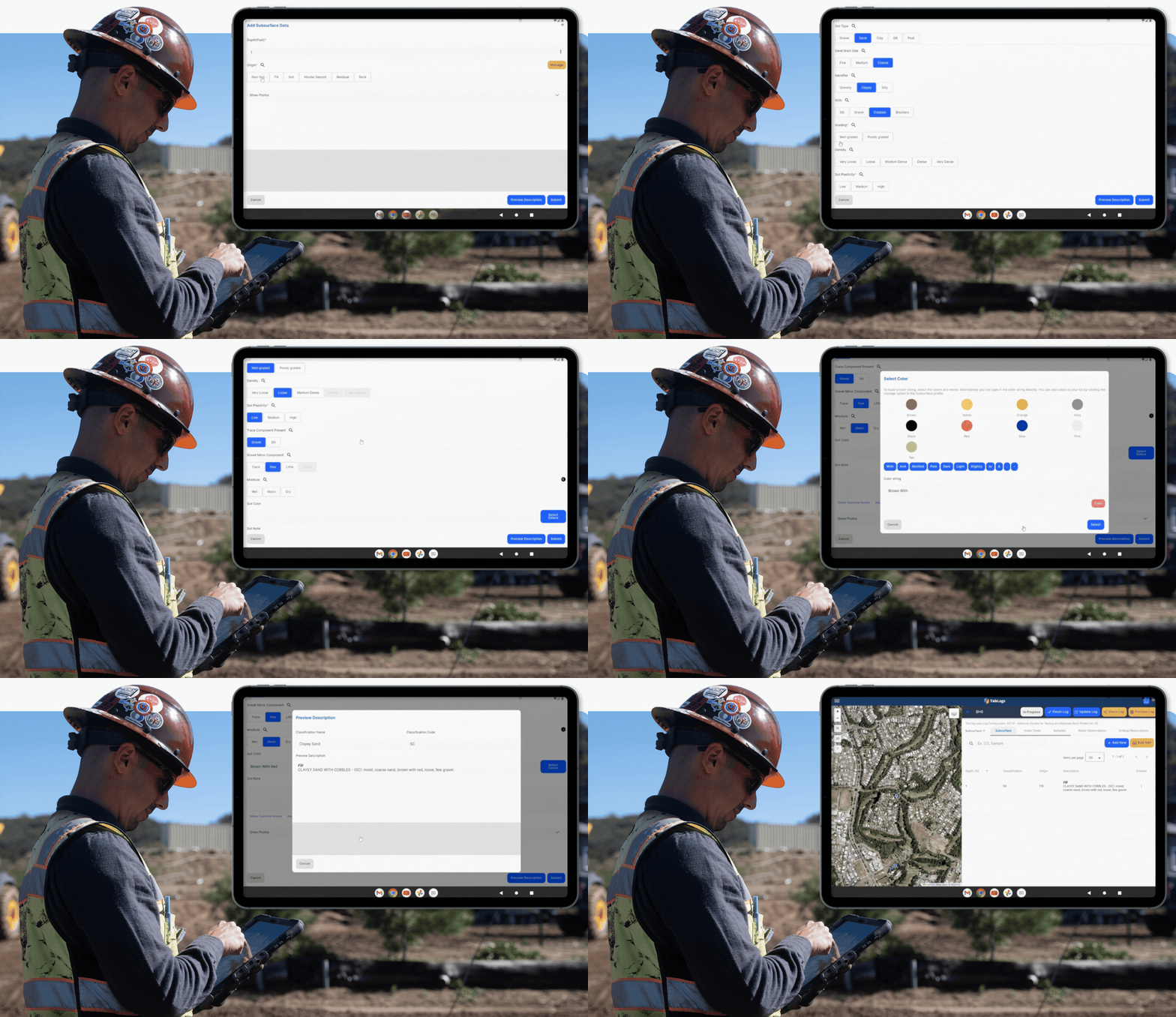
Digital Borehole Logging in the Field
Log boreholes in the field using our intuitive mobile interface. Capture data online or offline, log to the required standard and follow built‑in workflows for consistent results.
- Project brief information
- Log online and offline
- Log to the Standard you need
- Built in workflows
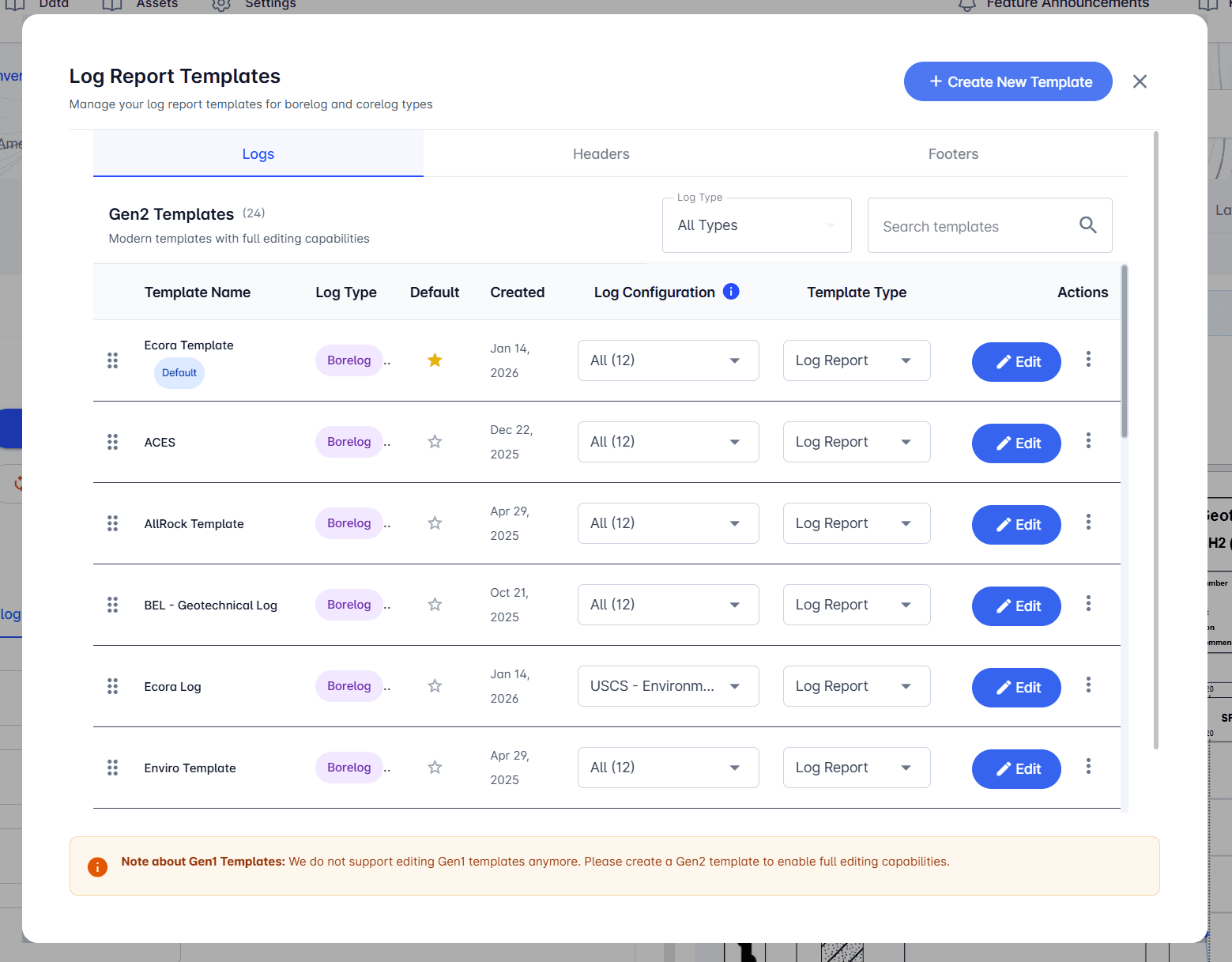
Customizable Boring Log Templates and Reports
Create and manage a library of customizable boring log templates designed to match your firm’s reporting standards and client requirements. Build professional reports using charts, photos, rock core imagery, and well diagrams, and update layouts as project needs and standards evolve. Generate consistent, high-quality reports while maintaining flexibility across geotechnical and environmental projects. Supported elements include:
- Charts
- Photos
- Rock core
- Well diagrams
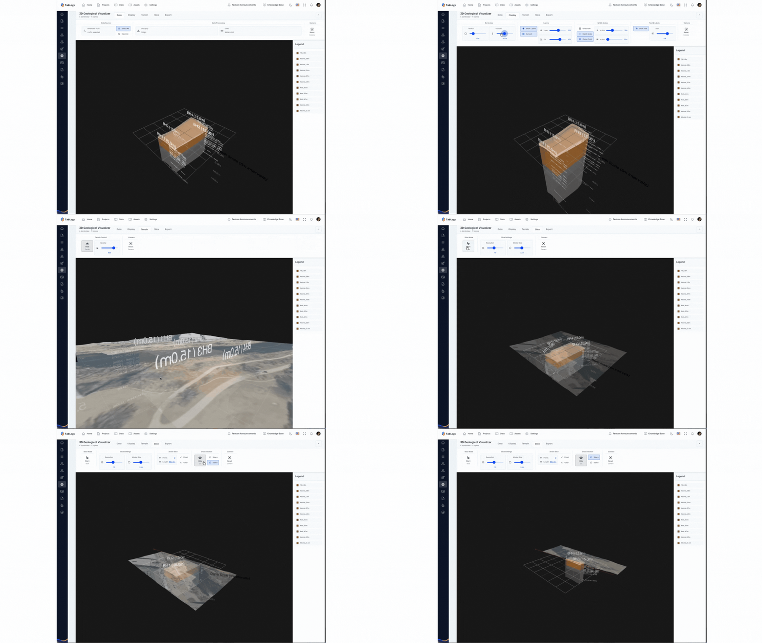
Visualize Borehole Data with GIS and 3D Models
With the TabLogs Visualizer you can display geological maps, long‑section diagrams, database queries, site plans, 3‑D models and photo logs. Plot boreholes on 3‑D site models and overlay geologic maps to gain deeper insight.
- Geological Maps
- Long Section Diagrams
- Database visualization and query
- Site plans
- 3D models
- Photo logs