A soil boring log is a standardized field record that documents subsurface conditions encountered during geotechnical drilling. It captures soil classification, sample depth, blow counts, groundwater observations, and field notes in a structured format. Geotechnical engineers use boring logs to assess site conditions for foundation design, slope stability analysis, earthworks, and environmental investigation.
What is a boring log used for?
Boring logs are the primary data source for geotechnical site investigations. They allow engineers to build a picture of subsurface stratigraphy across a site, identify changes in soil behaviour with depth, and locate groundwater. Regulatory bodies, structural engineers, and project owners rely on boring logs to make decisions about foundation type, excavation risk, and site suitability.
Common applications include:
- Foundation design for residential, commercial, and infrastructure projects
- Slope stability and retaining wall assessments
- Environmental site assessments and contamination investigations
- Mine and resource exploration programs
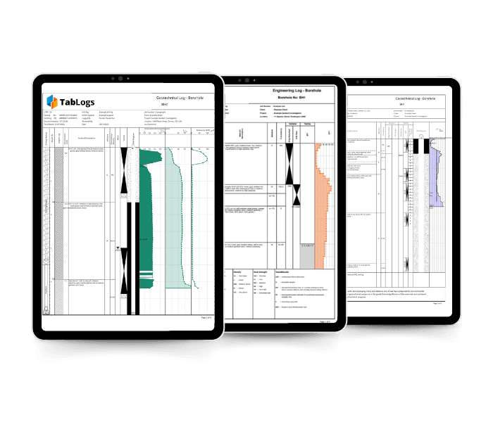
What information does a boring log record?
A complete boring log typically includes the following fields:
| Field | What it records | What to record on the log |
|---|---|---|
| Borehole ID | Unique Identifier for the hole | Record consistently across all logs, photos, and sample labels so everything can be cross-referenced without ambiguity. |
| Location and coordinates | Site position (easting, northing, elevation) | Record at the time of setup using your agreed coordinate system. Note the datum and projection used. |
| Drilling method | Auger, rotary, SPT, etc. | Record the method in use at the start of the log. Note any method changes and the depth at which they occurred. |
| Sample depth | Top and bottom depth of each sample interval | Record to the nearest 10mm. Note any discrepancy between planned and actual sample depth. |
| Soil classification | USCS or AS 1726 classification | If field based, label as visual manual identification. If lab confirmed, store the final group symbol tied to lab results. Keep both where possible. |
| Soil description | Colour, texture, consistency, moisture | Follow your regional standard: AS 1726 (Australia), BS EN ISO 14688 (UK), or ASTM D2488 (US). Record at time of logging, not from memory. |
| Blow counts (SPT N-value) | Resistance to penetration per 300mm drive | Record raw blows by increment (for example 6/8/9) and the final N value. Note refusal or unusual conditions. |
| Groundwater depth | Depth at which water was encountered | Record at the time of strike. Also note stabilised water level if measured after a waiting period. |
| Recovery | Percentage of sample recovered | Record as mm recovered vs mm driven, then convert to a percentage. Note probable cause where recovery is low. |
| Field notes | Drilling observations, equipment changes | Record in real time, not from memory at the end of the shift. |
How to read a boring log
Boring logs are read from top to bottom, representing the soil profile from the surface downward. Each row or stratum represents a layer encountered at a specific depth range. Start by checking the borehole ID, coordinates, and drilling date at the header. Then read through the soil descriptions column, noting where the soil type changes and at what depth. SPT blow counts increase with soil density and strength; a sudden spike can indicate a hard layer or obstruction. Groundwater depth, if recorded, is noted separately from the soil profile.
Key things to look for when interpreting a log:
- Consistent soil layers across multiple boreholes indicate uniform site conditions
- Variability between boreholes at the same depth signals lateral heterogeneity
- High blow counts at shallow depth may indicate fill or compacted material
- Soft layers (low blow counts, high moisture) at founding depth require further assessment
How to fill out a boring log correctly
Accurate boring logs depend on consistent field practice. The driller and geotechnical logger work together: the driller controls penetration rate and recovery; the logger classifies and records.
Best practice for field logging:
- Classify soil in accordance with your regional standard (USCS in the US, AS 1726 in Australia, BS EN ISO 14688 in the UK)
- Record observations in real time, not from memory at the end of the shift
- Note any drilling fluid changes, bit changes, or equipment issues as they occur
- Photograph each sample tray before and after classification
- Record groundwater observations immediately on water strike, not just at completion
Digital field logging tools reduce transcription errors and allow photos to be attached directly to each sample interval, keeping the record intact from field to office.
Boring log templates and software
A boring log can be completed on paper using a standard template, or digitally using geotechnical logging software. Paper logs require manual digitisation and are prone to transcription error. Digital logging captures data in structured, exportable formats (AGS, DIGGS, Excel) directly from the field. Free boring log templates are available in the TabLogs resource library, including formats compatible with USCS and AS 1726 classification systems.