Plan and Manage Geotechnical Site Investigations Across Canada
Centralised oversight for borehole logging, drill programs, SPT data, geotechnical reporting, QA review, and structured subsurface data management.
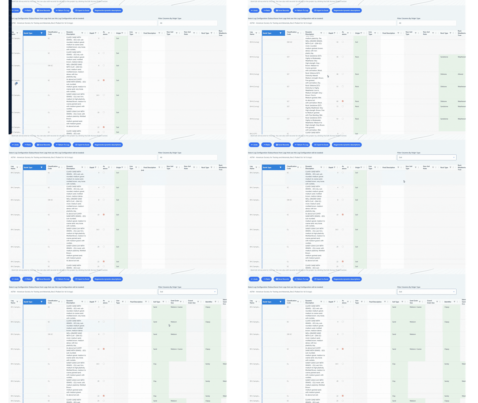
Designed for High Volume Office Workflows
The TabLogs Desktop Dashboard provides structured depth interval tables built for Canadian borehole logging standards and high-volume geotechnical office environments. Engineering teams can rapidly input lithology, sampling, groundwater observations, rock core recovery, RQD, SPT results, CPT data, test pits, and laboratory results within a consistent borehole database framework designed for accuracy and scalability. Bulk editing tools streamline the processing of contractor logs, historic drill hole records, legacy PDFs, and imported subsurface datasets from across provinces and territories.
- Structured Depth Interval Tables
- Multi Interval Editing
- Rapid SPT Capture
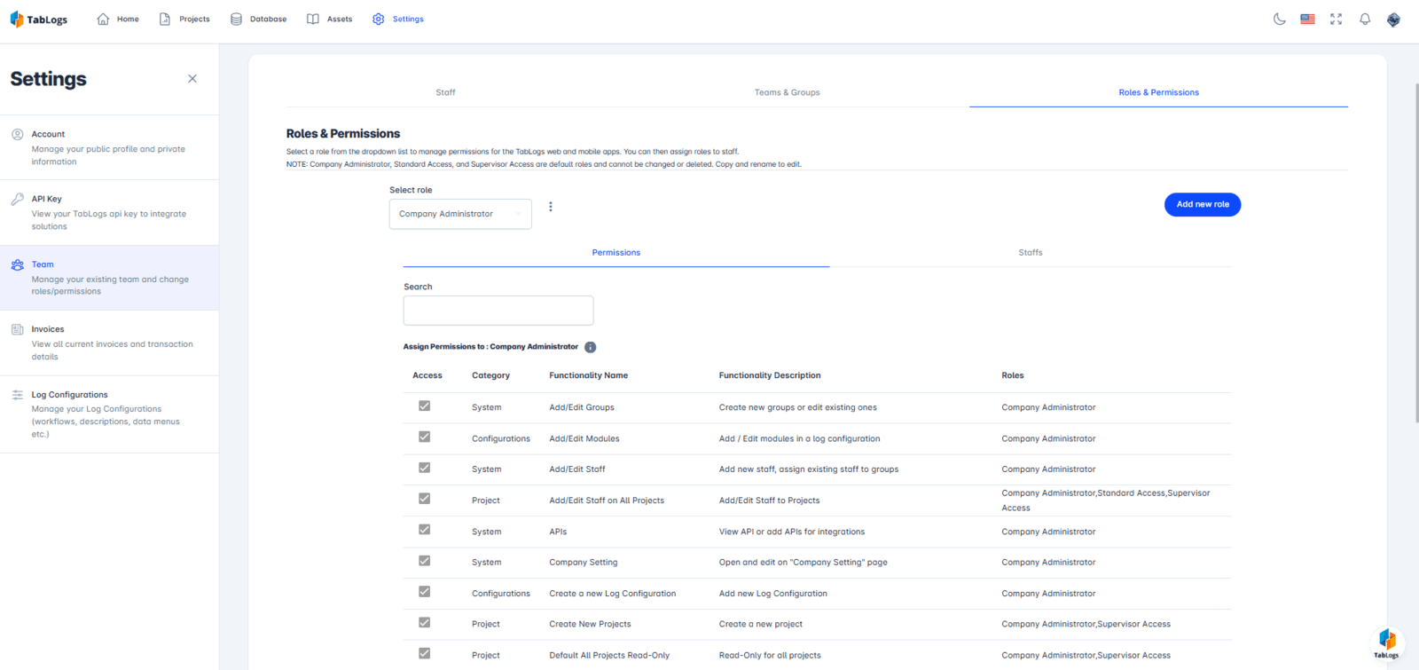
Manage Geotechnical Projects, Drill Rigs, and Teams in One System
Centralise drill program coordination and geotechnical project tracking within a single structured dashboard. Assign project engineers, coordinate drill crews, monitor borehole progress, manage subcontractors, and track timelines without relying on spreadsheets or disconnected systems. Gain clear oversight across transportation corridors, mining projects, municipal infrastructure, dams, foundations, renewable energy sites, and environmental investigations across Canada.
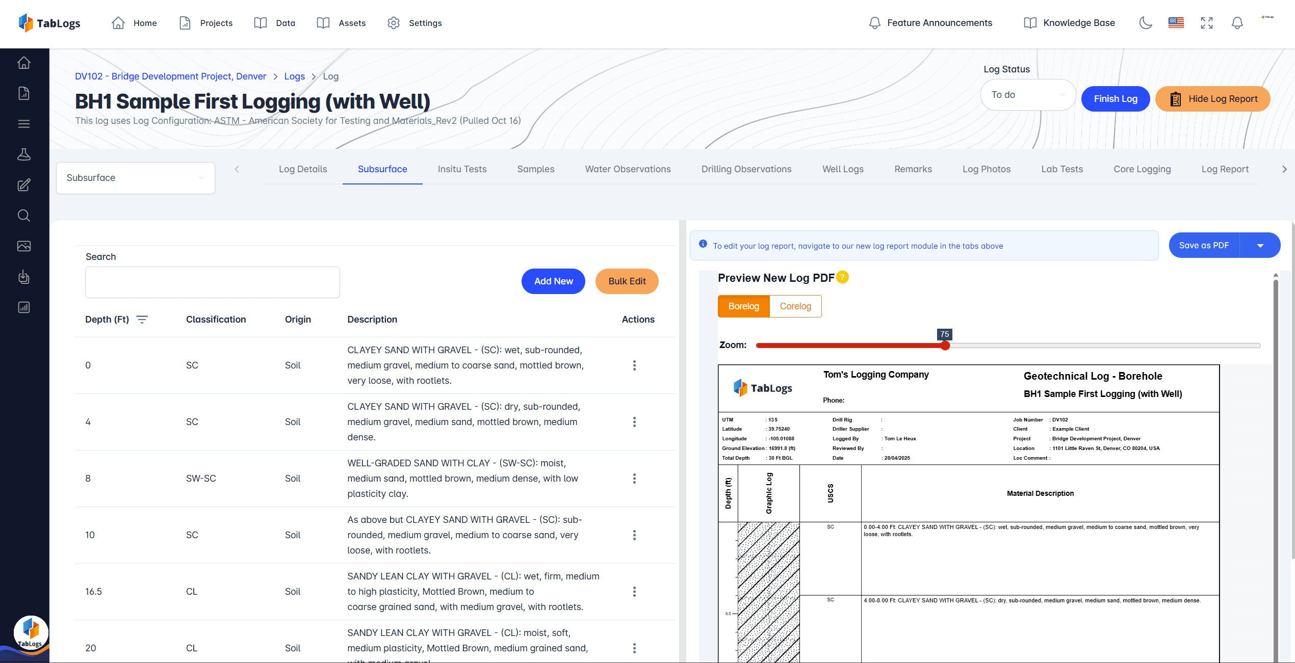
QA, Standardisation, and Structured Subsurface Data
Ensure consistency across offices and projects with standardised subsurface data structures tailored for Canadian geotechnical and environmental investigations. Review borehole logs, SPT values, rock core descriptions, laboratory results, and field observations for completeness and compliance before issuing geotechnical reports. Early identification of data gaps reduces rework, strengthens defensibility, and supports confident foundation design, slope stability assessment, ground improvement planning, and infrastructure development.
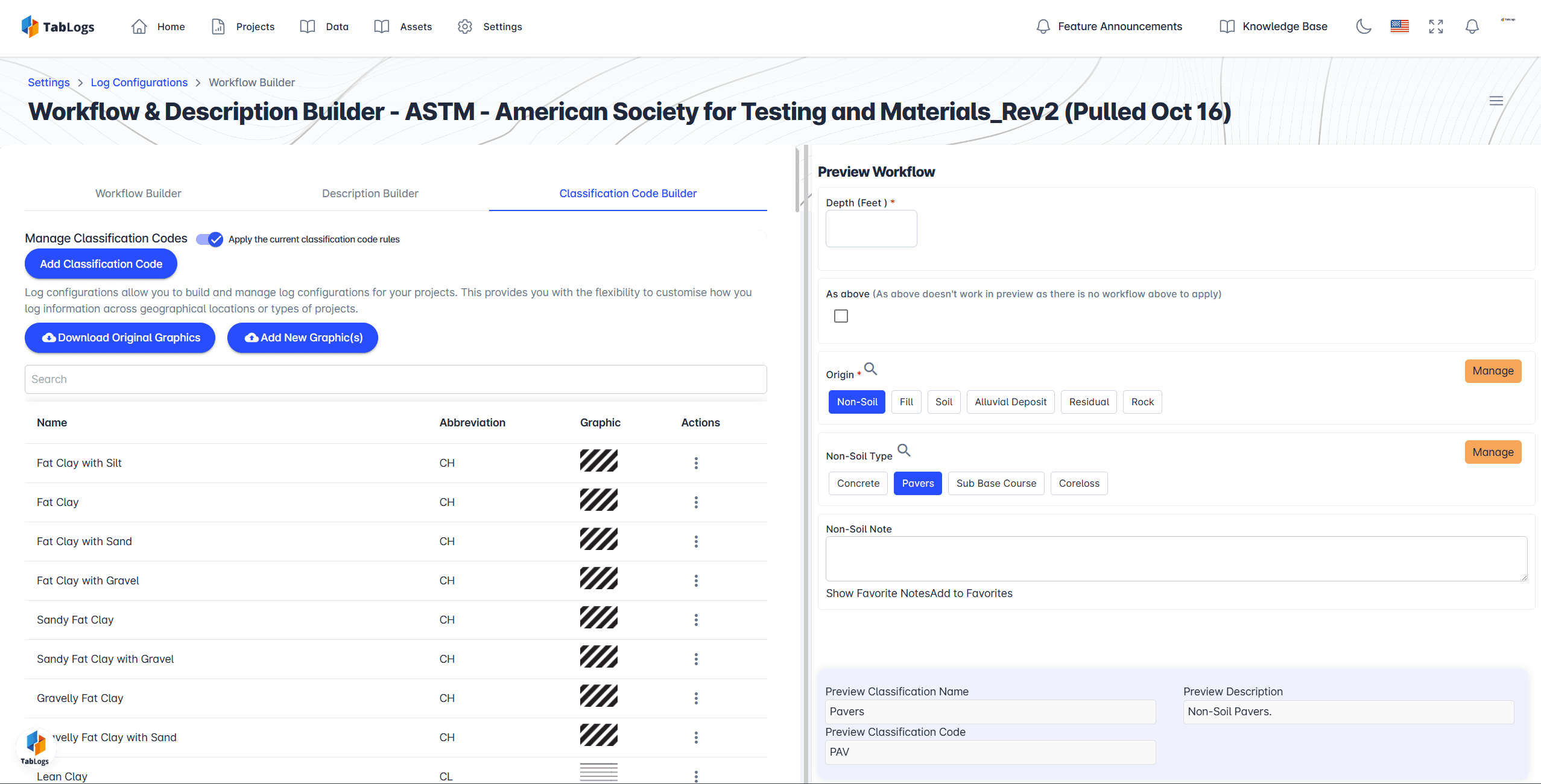
Custom Office Workflows Built for Geotechnical Teams
Configure approval stages, peer review checkpoints, reporting milestones, laboratory coordination, and deliverable tracking using a flexible workflow builder. Adapt processes for transportation geotechnics, mining investigations, foundation engineering, Phase II Environmental Site Assessments, contaminated sites investigations, and municipal infrastructure projects. Maintain visibility into project status, outstanding actions, reporting deadlines, and QA reviews without manual tracking systems or disconnected project management tools.
Real-Time Office Oversight of Field Investigations
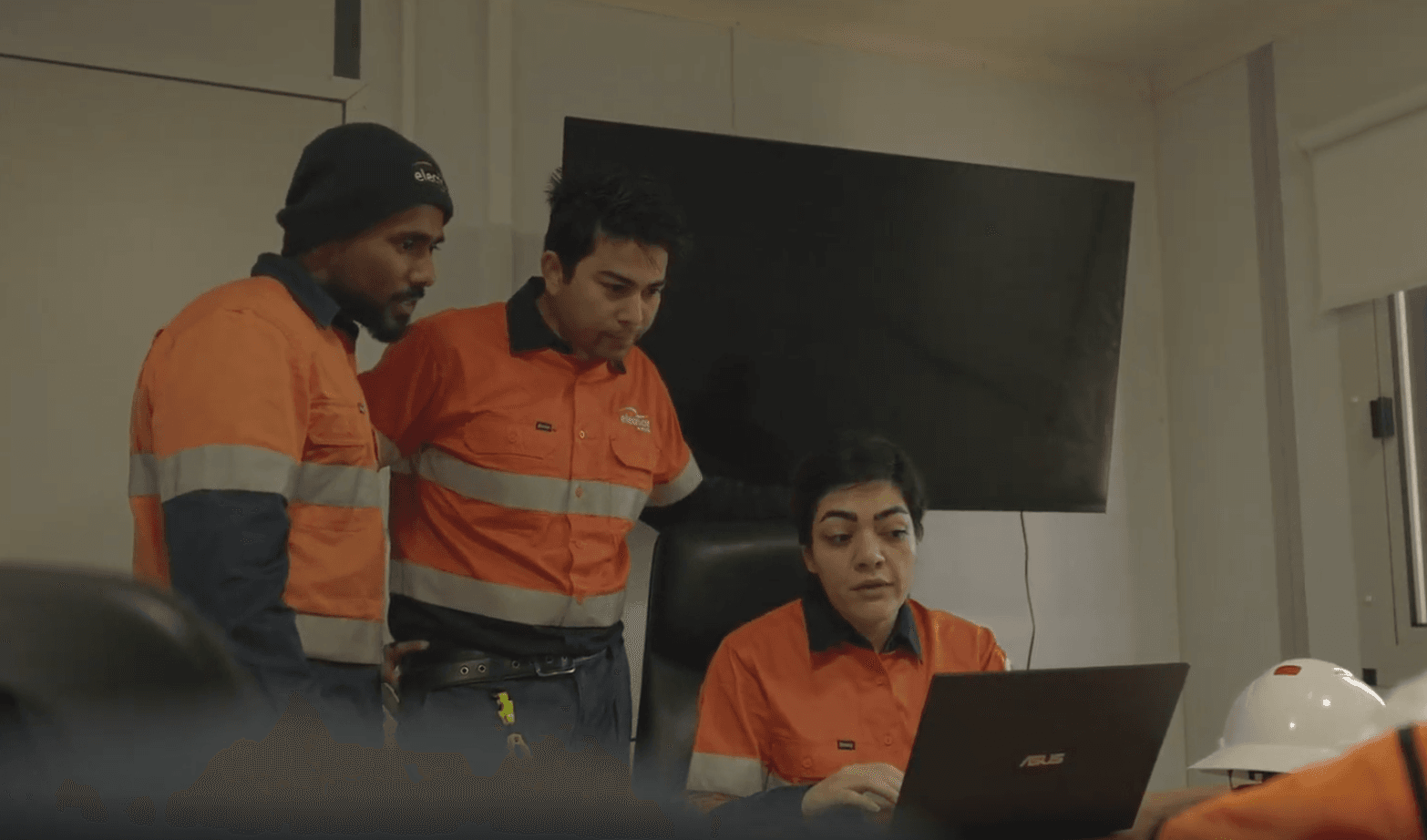
Office-based engineers can review and validate borehole logging data as it is collected in the field. Identify inconsistencies, missing depth intervals, incorrect SPT blow counts, groundwater recording gaps, or formatting issues early in the investigation lifecycle. Structured data capture reduces variability between drill crews and offices, improves geotechnical reporting accuracy, and significantly reduces manual correction time before issuing final deliverables.
- Status updates
- Send requests
Client Portal for Transparent Project Communication
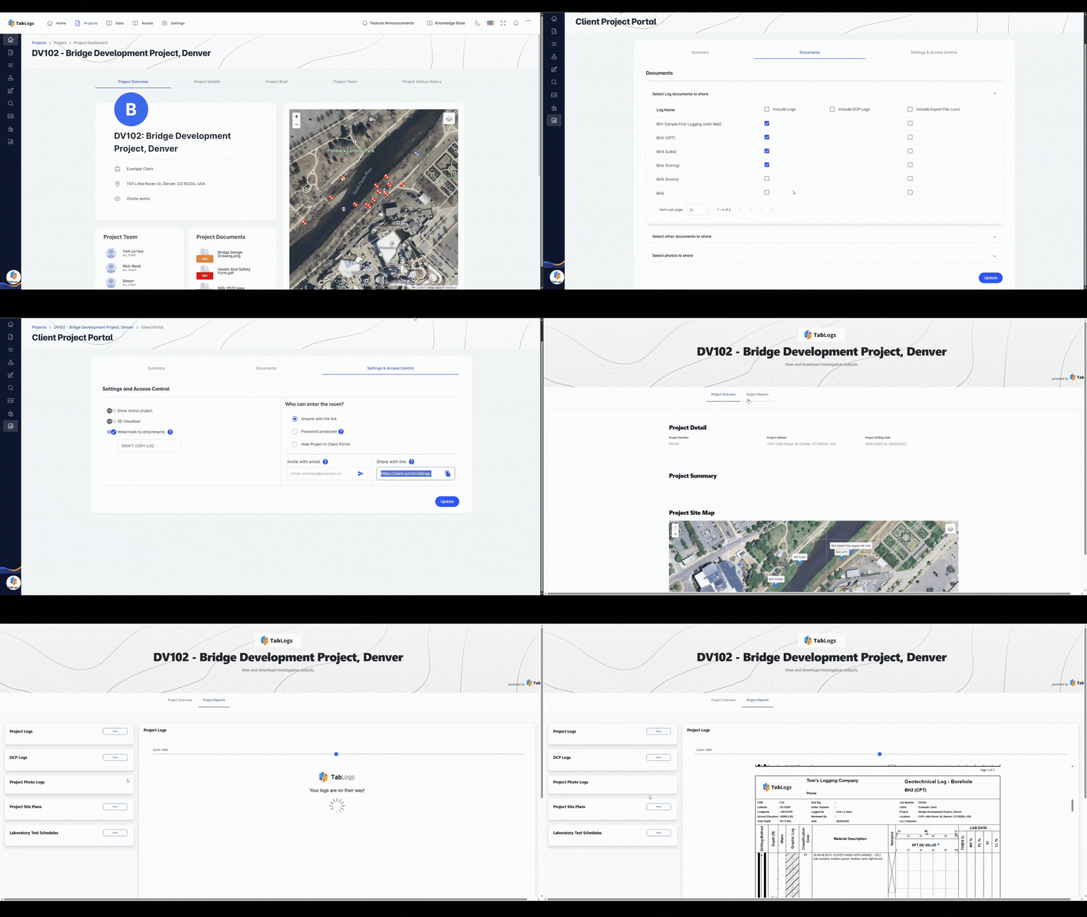
Provide controlled client access to approved borehole logs, subsurface profiles, laboratory results, monitoring data, and project documentation through a secure portal. Reduce back-and-forth email communication while maintaining full control over permissions and document visibility. Deliver a professional and transparent experience aligned with modern Canadian infrastructure, mining, environmental, and energy projects.
Replace Spreadsheets, gINT, and Legacy Geotechnical Software
Many Canadian geotechnical firms still rely on Excel spreadsheets, legacy desktop platforms, or fragmented systems such as gINT and OpenGround for borehole and subsurface data management. TabLogs centralises drill program oversight, structured logging, QA review, and geotechnical project visibility within a modern dashboard built for Canadian field and office collaboration. Improve consistency, reduce manual errors, standardise reporting inputs, and maintain long-term control of borehole and subsurface investigation data across provinces and offices.

Built for Office-Based Engineering Professionals
Used across Canadian transportation, environmental, municipal, mining, renewable energy, and infrastructure projects, the TabLogs Desktop Dashboard supports engineering teams delivering high-quality subsurface investigations at scale.
- Geotechnical project managers
- Senior and principal engineers
- Office-based reviewers and QA specialists
- Technical directors and discipline leads
- Environmental project managers overseeing Phase II ESAs
Ready to streamline your project management?
Start managing your geotechnical projects more efficiently today.