Features for Modern Borehole Logging and Geotechnical Teams in New Zealand
TabLogs brings together field logging, project management, QA processes and structured reporting into a single connected workflow. Designed for geotechnical and environmental engineers working across New Zealand, it supports consistent data capture, compliant reporting and seamless collaboration between field and office teams.
See TabLogs in action
Watch our 2-minute overview to see how TabLogs can transform your workflow.
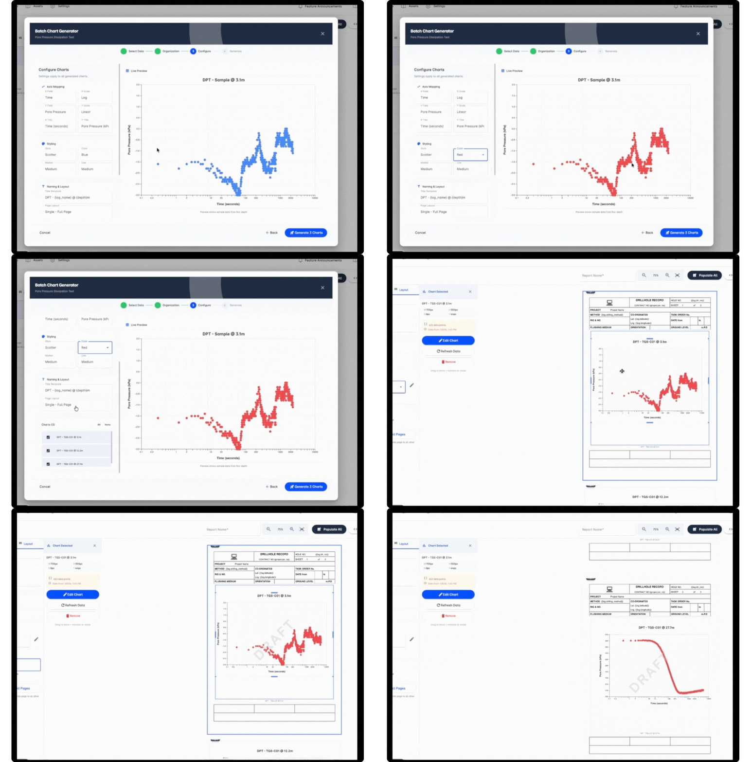
Compliant Borehole Reports, Structured Exports and Integrations
Deliver client-ready borehole log reports aligned with New Zealand geotechnical standards and project requirements. TabLogs produces structured, consistent outputs that support NZGS logging practices and NZS 4402 soil description standards. Your data remains fully structured and exportable for use across downstream workflows including design, laboratory testing and long-term database management.
- Professional borehole log reports aligned with NZGS and NZS 4402 conventions
- Structured data exports for CAD, GIS and laboratory systems
- Integration with existing geotechnical databases
- Open APIs for custom integrations and internal automation
- Consistent outputs across infrastructure, land development and environmental projects
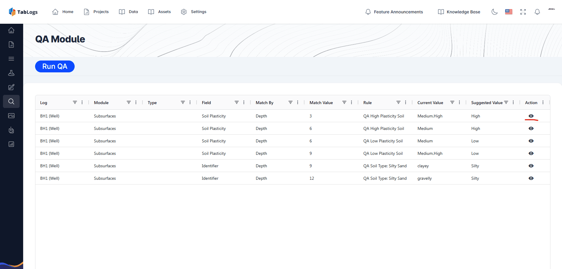
Built-In QA and Standardised Logging Workflows
Improve data quality at the point of capture. TabLogs applies structured logging workflows and validation rules that reduce inconsistencies between engineers, drilling crews and offices. Standardised terminology and controlled data entry help maintain internal QA processes and reduce time spent correcting logs before issue. Whether your team operates across Auckland, Wellington, Christchurch or regional projects, logging consistency is maintained across all sites.
- Structured soil and rock logging fields
- Controlled terminology aligned with NZ practice
- Validation rules to minimise errors
- Consistent logging across multiple offices and teams
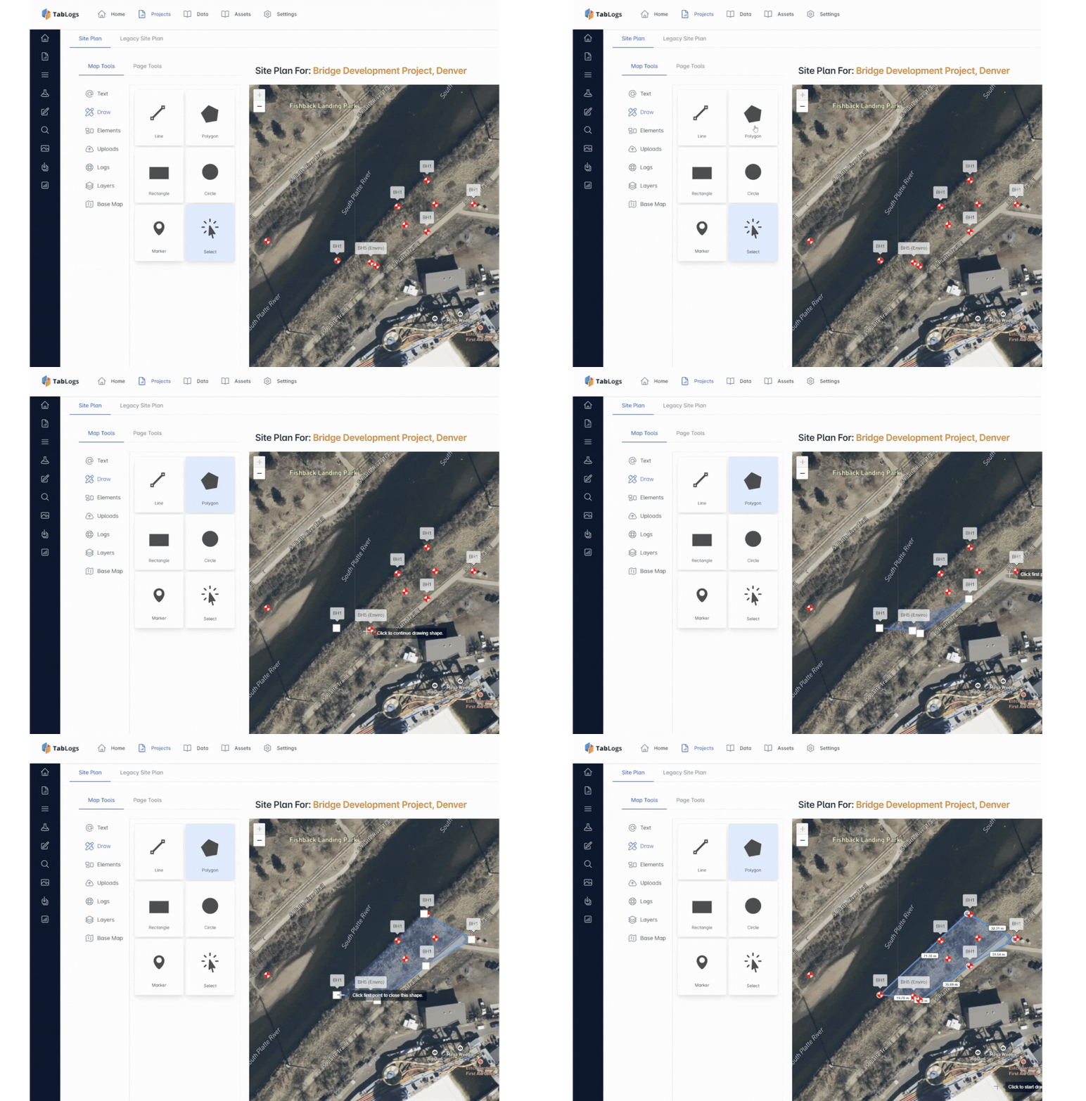
Plan and Manage Site Investigations Across New Zealand
Coordinate investigations from the office while maintaining real-time visibility of field activity. TabLogs centralises project information so office-based engineers can plan borehole locations, allocate field teams and track progress without waiting for paper logs or manual transfers. This supports projects delivered across both North and South Island, including infrastructure corridors, subdivisions, slope stability assessments and seismic risk investigations.
- Propose test and sampling schedules
- Assign user roles and permissions
- Capture field timesheets
- Import legacy borehole databases
- Export data into existing internal systems
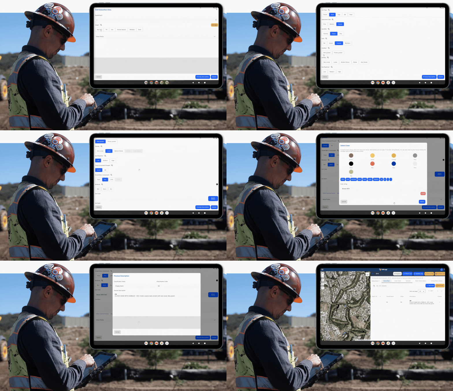
Digital Borehole Logging in the Field
Capture borehole data digitally while drilling, even in remote or low-connectivity regions. TabLogs enables engineers and technicians to log soil, rock, sampling and groundwater information directly in the field. Offline capability ensures investigations can continue in rural, alpine or coastal locations, with automatic synchronisation once connectivity returns.
- Log online or offline
- Capture project brief and drilling information
- Structured workflows aligned with NZ standards
- Real-time synchronisation with office teams
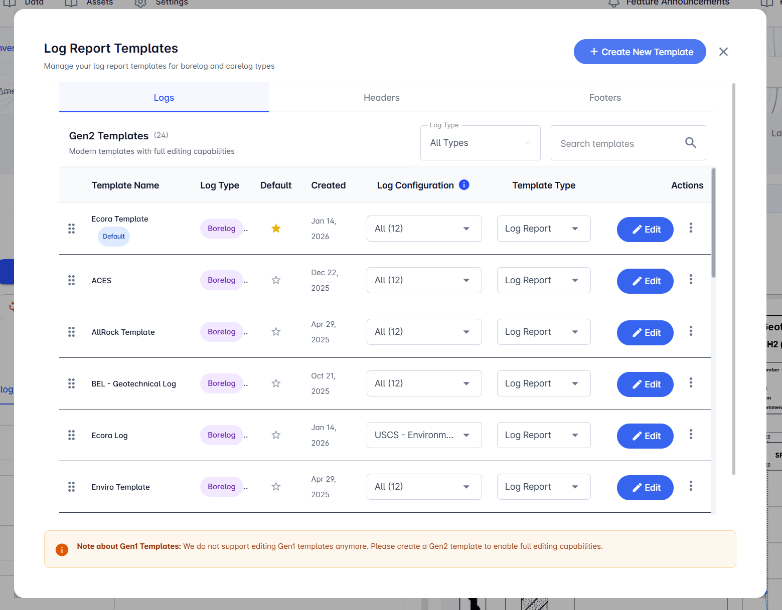
Customisable Borehole Log Templates
Maintain your firm’s reporting standards while adapting to different project types across New Zealand. Build and manage a library of customisable borehole log templates suited to geotechnical, environmental, transport and infrastructure projects. Ensure consistent formatting across teams while incorporating the visual and technical detail required for client delivery.
- Custom log layouts
- Charts and graphical soil profiles
- Photographs and rock core imagery
- Groundwater and well diagrams
- Consistent branding and formatting across projects
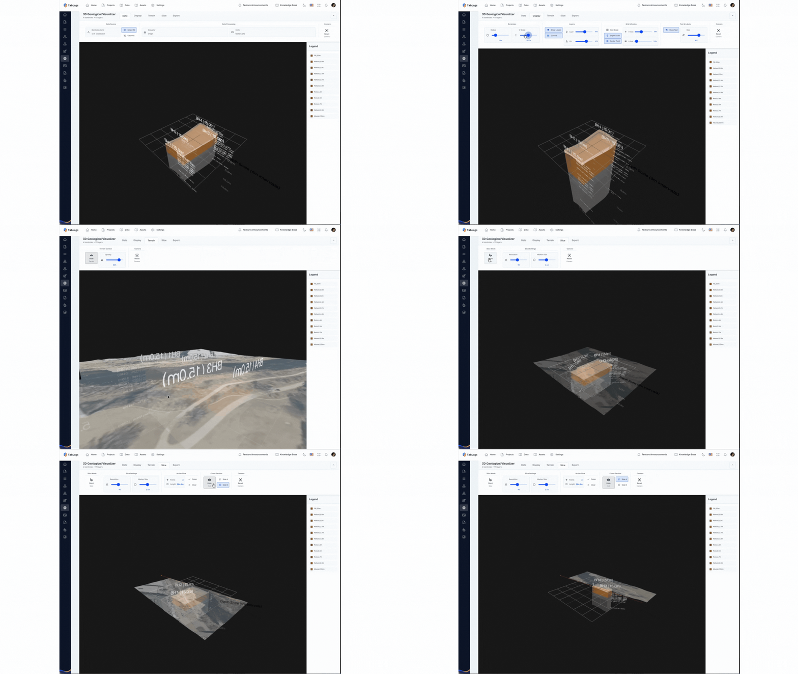
Visualise Borehole Data with GIS and 3D Models
Interpret subsurface conditions with spatial context. Interpret subsurface conditions with spatial context. TabLogs allows teams to map boreholes, review long sections and analyse subsurface variability within GIS and 3D environments. Visualisation tools support clearer internal technical review, improved client communication and better-informed design decisions, particularly on complex sites involving slope stability, liquefaction assessment or layered volcanic deposits.
- Geological and topographic mapping
- Long section diagrams
- Database querying and filtering
- Site plan overlays
- 3D subsurface models
- Photo log visualisation
Scalable Geotechnical Collaboration with Unlimited Users
Support collaboration across your entire organisation without restrictive per-user licensing. TabLogs allows unlimited users to log, review and edit data across projects, whether you operate as a single-office consultancy or a multi-branch national practice. Deploy across teams without increasing administrative complexity or project-based limitations.
- Unlimited projects and boreholes
- Scalable for growing engineering teams
- Predictable pricing structure
- Enterprise-grade security and user permissions
- Full control of your geotechnical data