Centralised Borehole Database for NZ Geotechnical Data
TabLogs provides a centralised borehole database for New Zealand geotechnical and environmental investigations. Store, search and reuse subsurface data across projects, regions and offices with consistent structure and long-term data control. Designed to support NZS 4402 testing practices and NZGS field descriptions, the database helps maintain technically defensible, standardised records ready for client, council and infrastructure reporting.
Database Management
Query & manage subsurface data
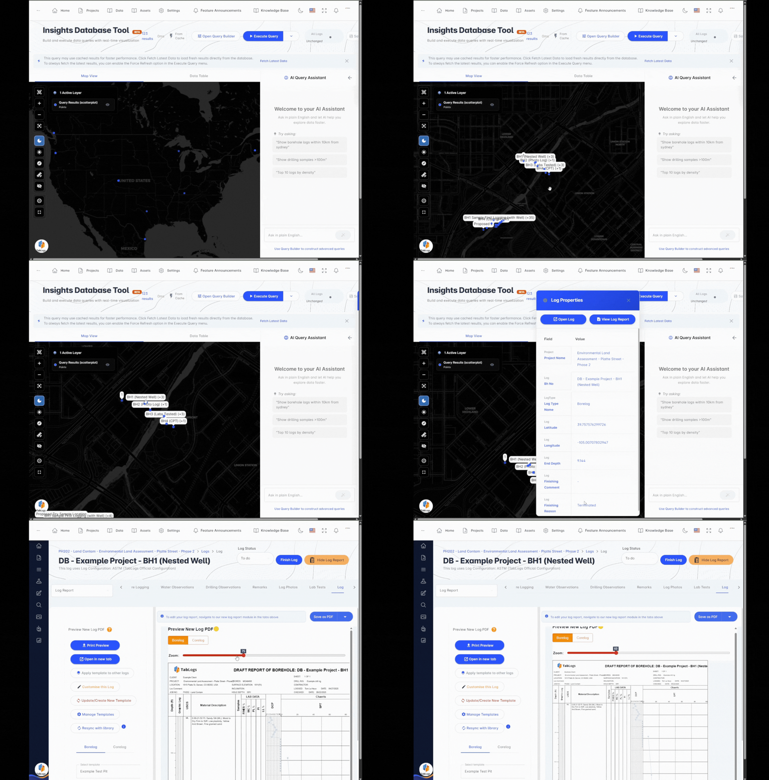
Built for Long-Term Geotechnical Data Management in New Zealand
TabLogs operates as a true borehole database, not just a collection of project files. All subsurface investigation data is stored within a structured schema aligned with AGS 4.1, supporting consistent formatting, long-term retention and reliable data exchange across NZ projects. Store and manage:
- Borehole and core logs
- CPT and in situ test data
- Test pits and trenches
- Groundwater monitoring wells
- Laboratory testing results
- Environmental site investigation data
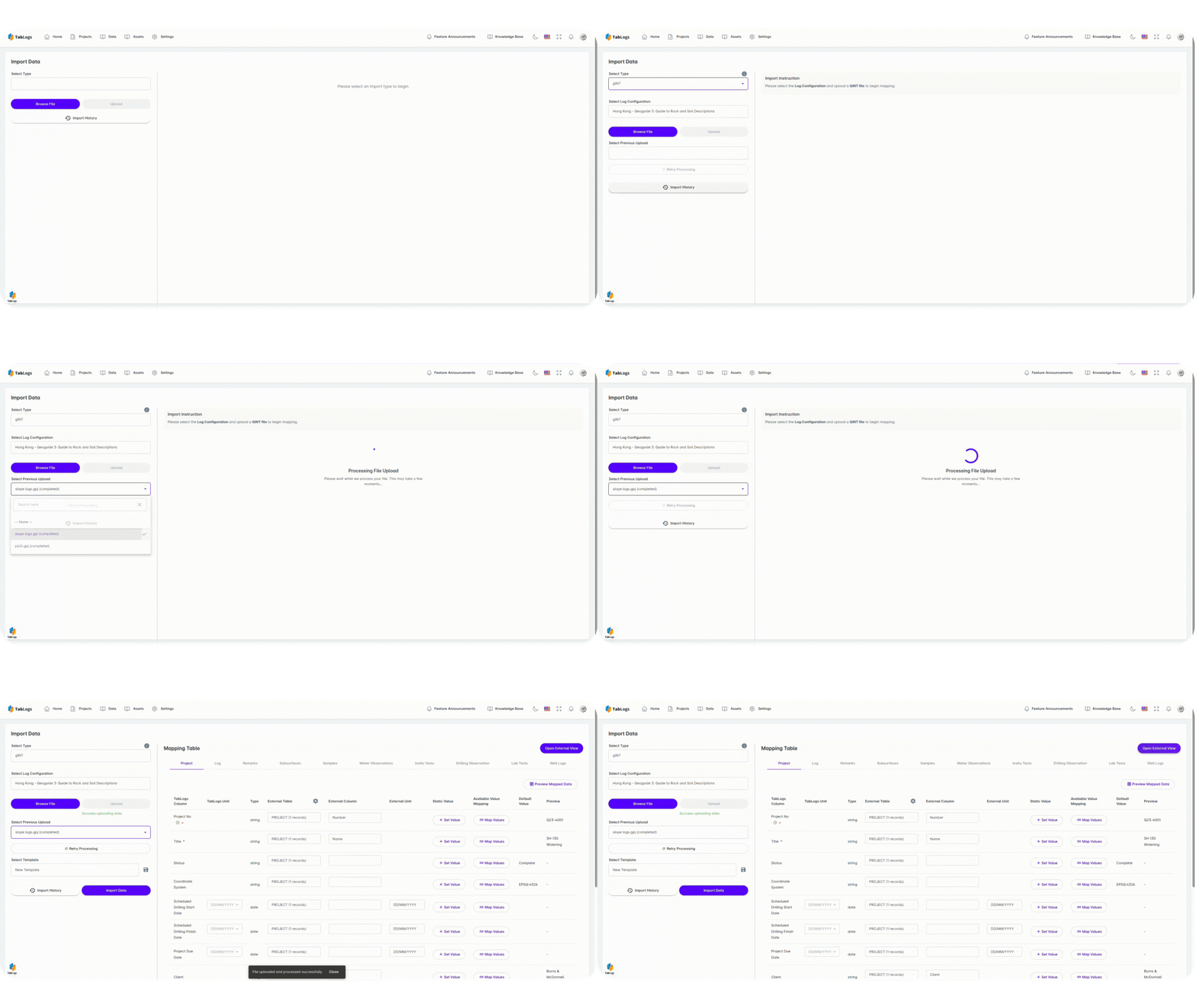
Import Legacy Data from gINT, OpenGround, Excel and Historical Project Files
Many New Zealand consultancies hold decades of investigation data in AGS files, Excel spreadsheets, PDFs and legacy database systems such as gINT or OpenGround. TabLogs provides a structured pathway to consolidate historical borehole data into one centralised NZ database environment.
- Import AGS 4.1 files directly
- Standardise legacy borehole logs into a structured database schema
- Consolidate disconnected regional or office-based databases
- Reduce manual re-entry of historical logs
- Maintain full ownership and control of your investigation records
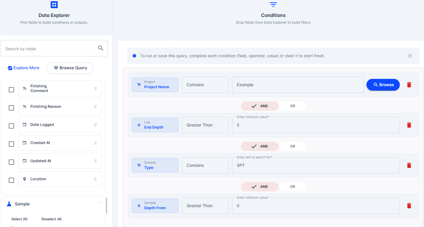
Search and Reuse Historical Borehole Data Across NZ Projects
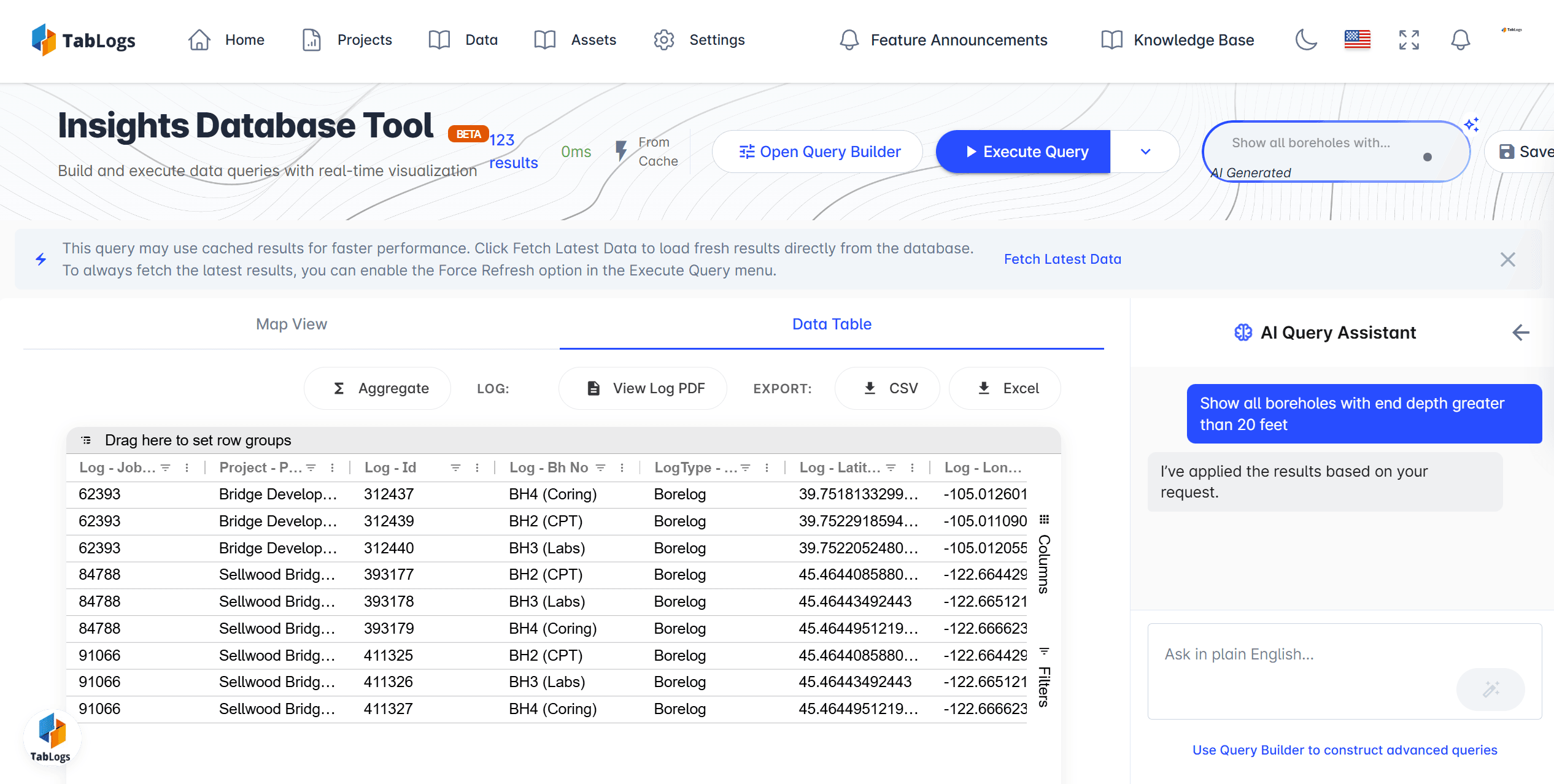
As your borehole database expands, historical investigations become an active engineering resource rather than archived reports. Maintain searchable investigation records that support compliance-driven reporting for transport infrastructure, land development and council review processes across New Zealand. Engineers can:
- Search boreholes by location, depth or project
- Filter by lithology, material type or test method
- Reference previous investigations during desktop studies
- Support feasibility assessments and proposal preparation
- Reduce uncertainty and unnecessary drilling
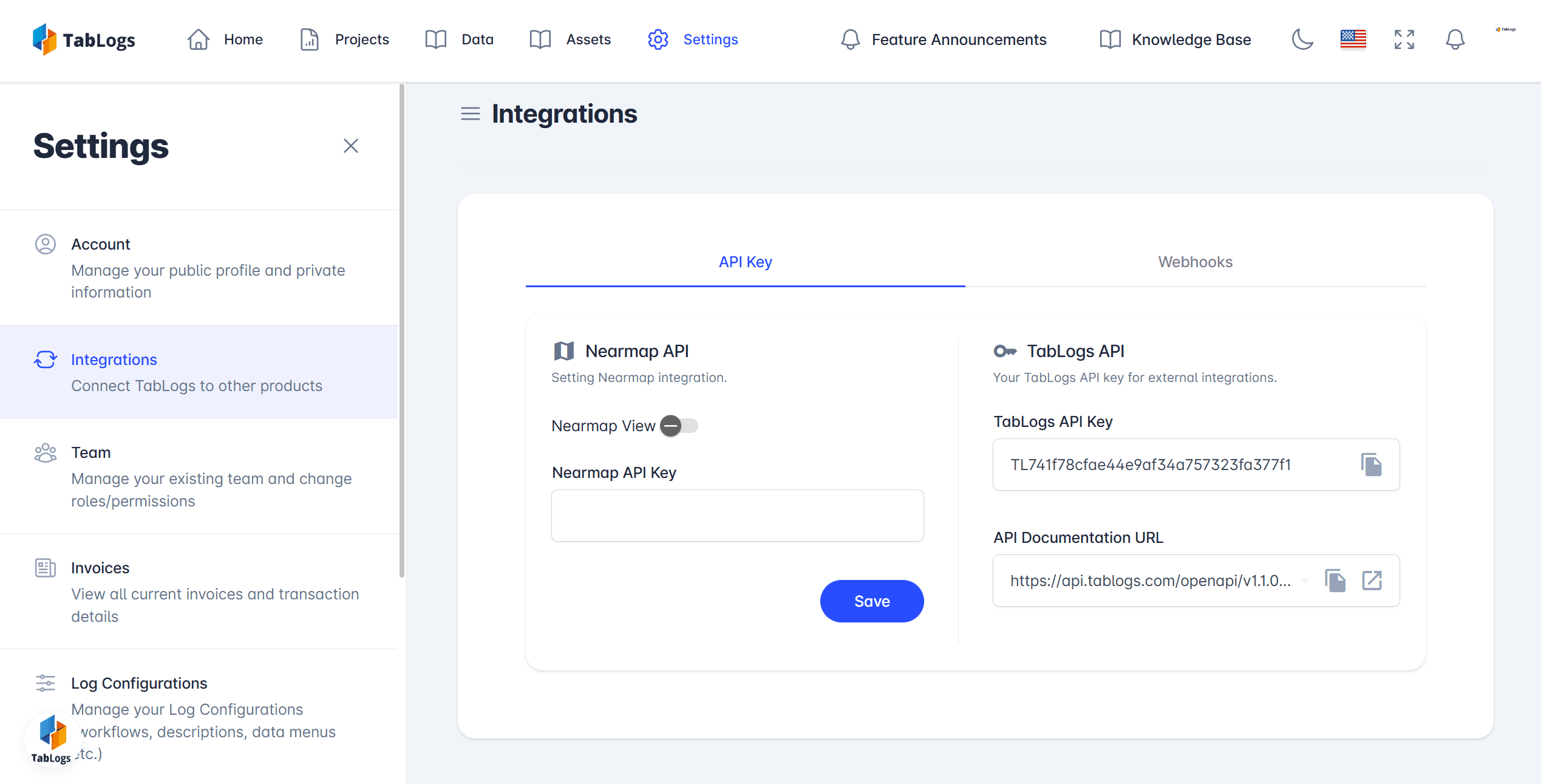
API and GIS Integration for Enterprise and Council Workflows
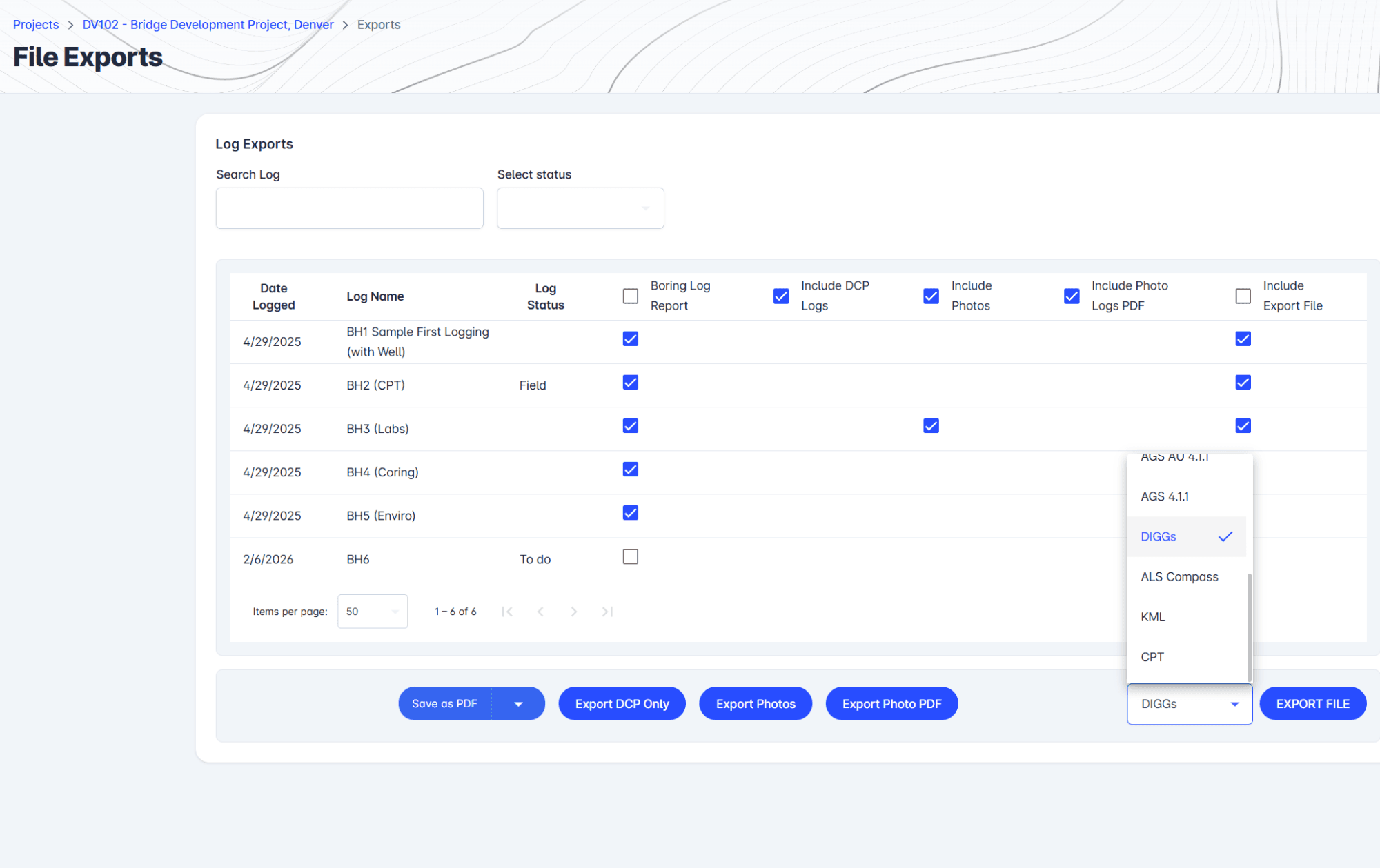
TabLogs integrates with existing engineering and GIS environments through structured exports and API access, ensuring your NZ geotechnical data remains portable and interoperable. Capabilities include:
- Integration with GIS platforms such as ArcGIS
- Structured exports for modelling and reporting
- Support for Power BI and analytics tools
- Custom API connections for enterprise or council environments
- Secure cloud access with controlled export permissions
A Modern Alternative to gINT, OpenGround and Spreadsheet-Based Databases
Traditional geotechnical databases often rely on local servers, isolated project folders or complex IT infrastructure. TabLogs provides a cloud-based alternative designed for continuous database growth across NZ projects. Many New Zealand firms rely on legacy platforms such as gINT, OpenGround or internally managed spreadsheet systems. TabLogs delivers a structured, centralised borehole database that reduces IT overhead while maintaining AGS alignment and long-term data integrity. Compared to legacy systems TabLogs emphasises:
- Structured and standardised borehole data architecture
- Cloud accessibility across offices and regions
- Continuous database growth across projects
- Simplified administration and onboarding
- Reduced reliance on internal IT infrastructure
Structured Borehole Database Architecture Aligned with NZ Standards
TabLogs supports structured subsurface data management aligned with NZS 4402 testing methods and NZGS field description guidelines, ensuring borehole data remains consistent and technically defensible across New Zealand projects. The platform also supports AGS 4.1 import and export for interoperability with international consultants and contractors when required. Benefits include:
- Alignment with NZS 4402 geotechnical testing standards
- Consistency with NZGS soil and rock description practices
- Improved readiness for NZTA and council data submissions
- Consistent formatting across offices and regions
- Improved long-term usability of borehole records
- Reduced risk of data loss, duplication or corruption
Ready to manage your data better?
Get all your subsurface data organized in one powerful platform.